File:2017 Sweden agricultural area per county in 2007-sv.svg

Size of this PNG preview of this SVG file: 396 × 599 pixels. Other resolutions: 159 × 240 pixels | 317 × 480 pixels | 508 × 768 pixels | 677 × 1,024 pixels | 1,355 × 2,048 pixels | 682 × 1,031 pixels.
Original file (SVG file, nominally 682 × 1,031 pixels, file size: 134 KB)
Captions
Captions
Add a one-line explanation of what this file represents

|
This file has been superseded by 2017 Sweden agricultural area per county in 2007-sv.png. It is recommended to use the other file. Please note that deleting superseded images requires consent. Reason to use the other file: "A PNG version of this file is now available."
|

|
Summary edit
| Description |
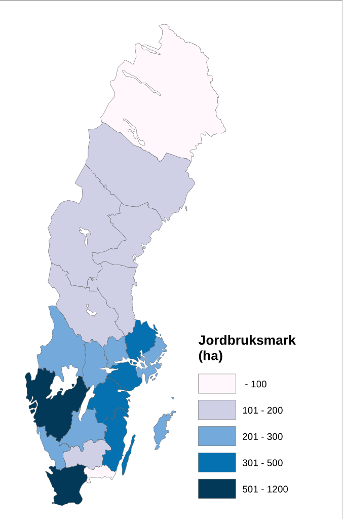
Svenska: Använd jordbruksareal per län för år 2007. |
| Date | |
| Source |
Own work
|
| Author | Moralist |
Licensing edit
| This file is made available under the Creative Commons CC0 1.0 Universal Public Domain Dedication. | |
| The person who associated a work with this deed has dedicated the work to the public domain by waiving all of their rights to the work worldwide under copyright law, including all related and neighboring rights, to the extent allowed by law. You can copy, modify, distribute and perform the work, even for commercial purposes, all without asking permission.
|
File history
Click on a date/time to view the file as it appeared at that time.
| Date/Time | Thumbnail | Dimensions | User | Comment | |
|---|---|---|---|---|---|
| current | 13:21, 21 November 2019 | | 682 × 1,031 (134 KB) | Moson81 (talk | contribs) | Reverted to version as of 08:59, 26 September 2017 (UTC)-trying to fix |
| 11:35, 19 May 2018 |  | 744 × 1,053 (238 KB) | Moralist (talk | contribs) | Corrected to the correct agricultural areas. | |
| 08:59, 26 September 2017 |  | 682 × 1,031 (134 KB) | Moralist (talk | contribs) | User created page with UploadWizard |
You cannot overwrite this file.
File usage on Commons
There are no pages that use this file.