File:20181109-FPAC-LSC-1375 (51071832737).jpg
Original file (3,944 × 2,369 pixels, file size: 6.66 MB, MIME type: image/jpeg)
Captions
Captions
Summary
edit.jpg&action=edit§ion=1)
| Description |
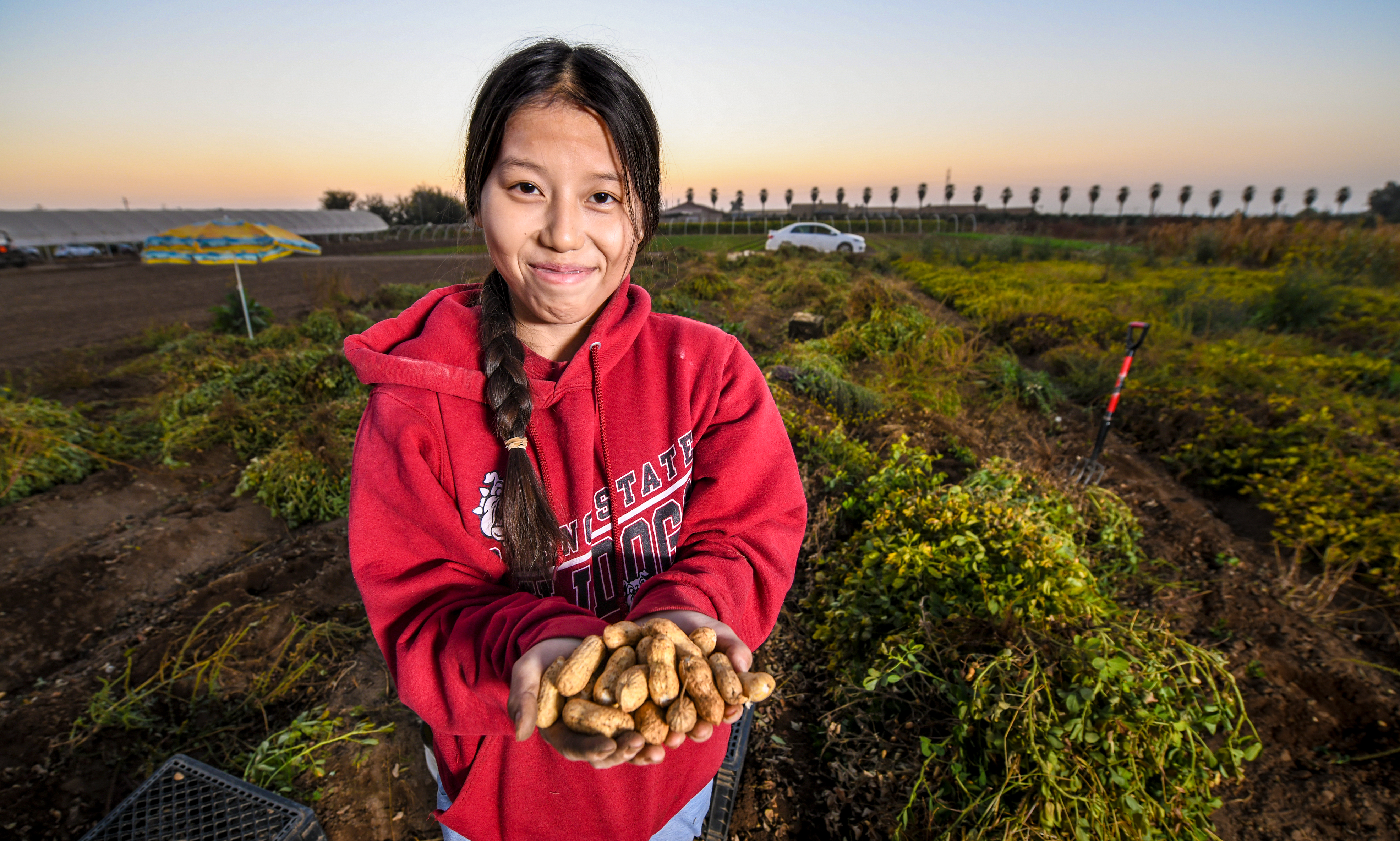
VH Produce owner Vue Her is a Hmong farmer on a 10-acre field, who grows several Asian specialty crops in Singer, CA, near Fresno, on November 9, 2018. He has worked with the U.S. Department of Agriculture (USDA) Natural Resource Conservation Service (NRCS) to implement many conservation improvements, including help replacing an old tractor for a more efficient lower emission tractor and installation of seasonal high tunnels. Farm Production and Conservation (FPAC) is the Department’s focal point for the nation’s farmers and ranchers and other stewards of private agricultural lands and non-industrial private forest lands. FPAC agencies implement programs designed to mitigate the significant risks of farming through crop insurance services, conservation programs, and technical assistance, and commodity, lending, and disaster programs. The agencies and services supporting FPAC are Farm Service Agency (FSA), Natural Resources Conservation Service (NRCS), and Risk Management Agency (RMA). Natural Resources Conservation Service has a proud history of supporting America’s farmers, ranchers, and forest landowners for more than 80 years. USDA helps people make investments in their operations and local communities to keep working lands working, boost rural economies, increase the competitiveness of American agriculture, and improve the quality of our air, water, soil, and habitat. USDA Photo by Lance Cheung. |
| Date | |
| Source | 20181109-FPAC-LSC-1375 |
| Author | Lance Cheung/Multimedia PhotoJournalist |
| Permission (Reusing this file) |
Flinfo has extracted the license below from the metadata of the image (tag "IFD0:ImageDescription" contained "USDA Photo"). The license visible at Flickr was "Public Domain Mark". |
| Camera location | | View this and other nearby images on: OpenStreetMap |
|---|
.jpg¶ms=036.766333_N_-119.588314_E_globe:Earth_type:camera_source:Flickr_&language=en)
Licensing
edit.jpg&action=edit§ion=2)
This image or file is a work of a United States Department of Agriculture employee, taken or made as part of that person's official duties. As a work of the U.S. federal government, the image is in the public domain.
|
 |
| This image was originally posted to Flickr by USDAgov at https://flickr.com/photos/41284017@N08/51071832737. It was reviewed on 16 March 2024 by FlickreviewR 2 and was confirmed to be licensed under the terms of the Public Domain Mark. |
File history
Click on a date/time to view the file as it appeared at that time.
| Date/Time | Thumbnail | Dimensions | User | Comment | |
|---|---|---|---|---|---|
| current | 20:34, 16 March 2024 | | 3,944 × 2,369 (6.66 MB) | Sintegrity (talk | contribs) | Transferred from Flickr via #flickr2commons |
You cannot overwrite this file.
File usage on Commons
There are no pages that use this file.
.jpg&oldid=876736050)