File:2019-01-19.Terra MODIS.125m.Deutschland, Ostschweiz, Österreich und Norditalien.jpg

Size of this preview: 627 × 599 pixels. Other resolutions: 251 × 240 pixels | 502 × 480 pixels | 804 × 768 pixels | 1,072 × 1,024 pixels | 2,143 × 2,048 pixels | 9,377 × 8,961 pixels.
Original file (9,377 × 8,961 pixels, file size: 9.84 MB, MIME type: image/jpeg)
Captions
Captions
Add a one-line explanation of what this file represents
Summary edit
| Warning | The original file is very high-resolution. It might not load properly or could cause your browser to freeze when opened at full size. |
|---|
| Description |
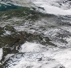
English: Satellite picture of Germany, Eastern Switzerland, Austria and Northern Italy on 19 January 2019
Deutsch: Satellitenbild Deutschlands, der Ostschweiz, Österreichs und Norditaliens am 19. Januar 2019 |
| Date | |
| Source | https://gibs.earthdata.nasa.gov/image-download?TIME=2019019&extent=5.185546875000001,45.24609375000001,15.486328125,55.08984375000001&epsg=4326&layers=MODIS_Terra_CorrectedReflectance_TrueColor,Coastlines&opacities=1,1&worldfile=false&format=image/jpeg&width=9377&height=8961 |
| Author | NASA, Terra MODIS / Grenzen von Open Streeet Map Community |
Licensing edit
| This file is in the public domain in the United States because it was solely created by NASA. NASA copyright policy states that "NASA material is not protected by copyright unless noted". (See Template:PD-USGov, NASA copyright policy page or JPL Image Use Policy.) | ||
 |
Warnings:
|
File history
Click on a date/time to view the file as it appeared at that time.
| Date/Time | Thumbnail | Dimensions | User | Comment | |
|---|---|---|---|---|---|
| current | 21:59, 20 January 2019 | | 9,377 × 8,961 (9.84 MB) | Matthiasb (talk | contribs) | {{Information |description ={{en|1=Satellite picture of Germany, Eastern Switzerland, Austria and Northern Italy on 19 January 2019}} {{de|1=Satellitenbild Deutschlands, der Ostschweiz, Österreichs und Norditaliens am 19. Januar 2019}} |date =2019-01-19 |source =https://gibs.earthdata.nasa.gov/image-download?TIME=2019019&extent=5.185546875000001,45.24609375000001,15.486328125,55.08984375000001&epsg=4326&layers=MODIS_Terra_CorrectedReflectance_TrueColor,Coastlines&opacities=1... |
You cannot overwrite this file.
File usage on Commons
The following page uses this file:
File usage on other wikis
The following other wikis use this file:
- Usage on de.wikipedia.org