File:2019-10-31 13-50-28 Cerro Polleras.jpg

Size of this preview: 800 × 533 pixels. Other resolutions: 320 × 213 pixels | 640 × 427 pixels | 1,024 × 683 pixels | 1,280 × 853 pixels | 2,560 × 1,707 pixels | 3,648 × 2,432 pixels.
Original file (3,648 × 2,432 pixels, file size: 3.21 MB, MIME type: image/jpeg)
Captions
Captions
Add a one-line explanation of what this file represents
Summary edit
| Description |
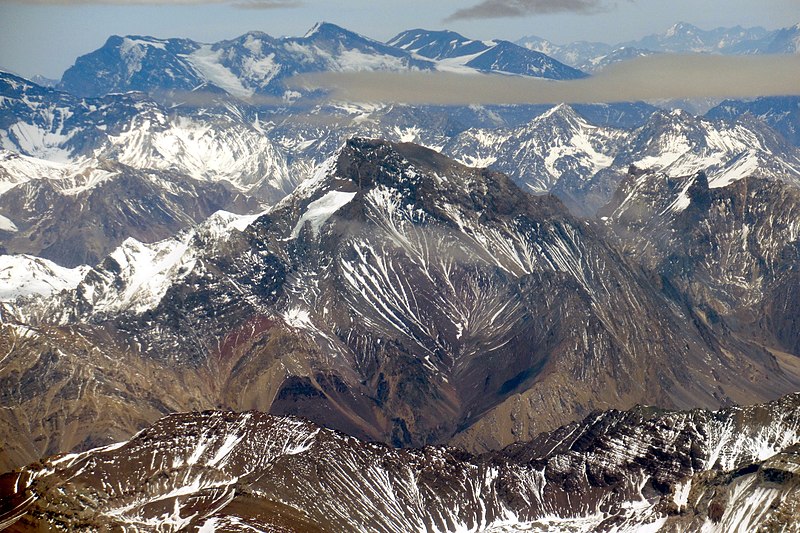
Español: Cerro Polleras (5593 m s.n.m., distancia 40 km) en el centro; cerro Chimbote (5494 m s.n.m., distancia 45 km) por su derecha; el Marmolejo (6108 m s.n.m., distancia 95 km) con el San José al fondo. Altitud de vuelo 7700 m s.n.m. aproximadamente. |
| Date | 31 October 2019, 13:50:28 (according to Exif data) |
| Source | Own work |
| Author | WeHaKa |
| Permission (Reusing this file) |
This file is licensed under the Creative Commons Attribution-Share Alike 4.0 International license. Attribution: WeHaKa
|
| Camera location | | View this and other nearby images on: OpenStreetMap |
|---|
| Object location | | View this and other nearby images on: OpenStreetMap |
|---|
| Annotations | This image is annotated: View the annotations at Commons |
File history
Click on a date/time to view the file as it appeared at that time.
| Date/Time | Thumbnail | Dimensions | User | Comment | |
|---|---|---|---|---|---|
| current | 23:29, 15 December 2019 | | 3,648 × 2,432 (3.21 MB) | WeHaKa (talk | contribs) | {{Information |description = {{es| Cerro Polleras (5593 m s.n.m., distancia 40 km) en el centro; cerro Chimbote (5494 m s.n.m., distancia 45 km) por su derecha; el Marmolejo (6108 m s.n.m., distancia 95 km) con el San José al fondo. Altitud de vuelo 7700 m s.n.m. aproximadamente. }} |date = {{According to EXIF data|2019-10-31 13:50:28}} |source = {{own}} |author = WeHaKa |permission = {{cc-by-sa-4.0|WeHaKa}} |other versions = }} {{came... |
You cannot overwrite this file.
File usage on Commons
The following 2 pages use this file:
File usage on other wikis
The following other wikis use this file:
- Usage on ceb.wikipedia.org
- Usage on www.wikidata.org