File:22-W 1939 track.png

Size of this preview: 800 × 458 pixels. Other resolutions: 320 × 183 pixels | 640 × 366 pixels | 1,024 × 586 pixels | 1,366 × 782 pixels.
Original file (1,366 × 782 pixels, file size: 315 KB, MIME type: image/png)
Captions
Captions
Add a one-line explanation of what this file represents
| Description |
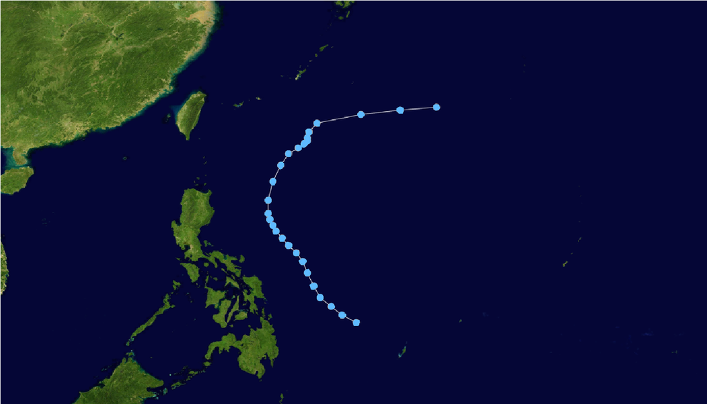
English: Track of 22-W from November 7, 1939 through November 14, 1939. Due to the age at witch this storm was observed from, one cannot rely on this track to be 100% accurate, but rather just a reference as to where the storm happened and the relative direction it traveled. |
||
| Date | |||
| Source | Track data provided by Ibtracs, land image from NASA | ||
| Author | Supportstorm | ||
| Permission (Reusing this file) |
|
| Storm data |
|---|
File history
Click on a date/time to view the file as it appeared at that time.
| Date/Time | Thumbnail | Dimensions | User | Comment | |
|---|---|---|---|---|---|
| current | 20:31, 5 July 2014 | | 1,366 × 782 (315 KB) | Typhoon2013 (talk | contribs) | Tropical depression right? |
| 22:54, 22 February 2012 |  | 2,700 × 1,669 (1.27 MB) | Supportstorm (talk | contribs) | {{Information |Description ={{en|1=Track of 22-W from November 7, 1939 through November 14, 1939. Due to the age at witch this storm was observed from, one cannot rely on this track to be 100% accurate, but rather just a reference as to where the st... |
You cannot overwrite this file.
File usage on Commons
There are no pages that use this file.
File usage on other wikis
The following other wikis use this file:
- Usage on th.wikipedia.org
- Usage on zh.wikipedia.org