File:3-4 view of south and east elevations. HAER PR, 6-MAGU, 1C-2 - Hacienda Buena Vista, PR Route 10 (Ponce to Arecibo), Magueyes, Ponce Municipio, PR HAER PR,6-MAGU,1-39.tif
Size of this JPG preview of this TIF file: 800 × 575 pixels. Other resolutions: 320 × 230 pixels | 640 × 460 pixels | 1,024 × 736 pixels | 1,280 × 920 pixels | 2,560 × 1,840 pixels | 5,000 × 3,593 pixels.
Original file (5,000 × 3,593 pixels, file size: 17.14 MB, MIME type: image/tiff)
Captions
Captions
Add a one-line explanation of what this file represents
Summary edit
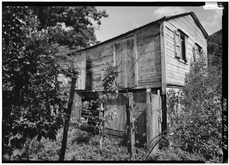
| 3-4 view of south and east elevations. HAER PR, 6-MAGU, 1C-2 - Hacienda Buena Vista, PR Route 10 (Ponce to Arecibo), Magueyes, Ponce Municipio, PR | ||||
|---|---|---|---|---|
| Title |
3-4 view of south and east elevations. HAER PR, 6-MAGU, 1C-2 - Hacienda Buena Vista, PR Route 10 (Ponce to Arecibo), Magueyes, Ponce Municipio, PR |
|||
| Description |
Vives, Salvador de; Diaz, Maria Isabel; Vives, Carlos Maria; Navarro, Guillerma; Vives-Navarro, Salvador; Vives, Guillermo; Vives, Carlos; Vives Brothers Company; Cary, Brian, transmitter; Egbert, Charles, field team; Yearby, Jean, transmitter; Boucher, Jack, photographer; Nistal-Moret, Benjamin, historian; Sanchez, Hector, historian |
|||
| Depicted place | Puerto Rico; Ponce Municipio; Magueyes | |||
| Date | Documentation compiled after 1968 | |||
| Dimensions | 5 x 7 in. | |||
| Current location |
Library of Congress Prints and Photographs Division Washington, D.C. 20540 USA http://hdl.loc.gov/loc.pnp/pp.print |
|||
| Accession number |
HAER PR,6-MAGU,1-39 |
|||
| Credit line |
|
|||
| Notes |
|
|||
| Source | https://www.loc.gov/pictures/item/pr0030.photos.143516p | |||
| Permission (Reusing this file) |
|
|||

| Object location | | View this and other nearby images on: OpenStreetMap |
|---|
File history
Click on a date/time to view the file as it appeared at that time.
| Date/Time | Thumbnail | Dimensions | User | Comment | |
|---|---|---|---|---|---|
| current | 09:58, 1 August 2014 |  | 5,000 × 3,593 (17.14 MB) | Fæ (talk | contribs) | GWToolset: Creating mediafile for Fæ. HABS 31 July 2014 (3000:3200) |
You cannot overwrite this file.
File usage on Commons
The following page uses this file: