File:34th St 5th 6th Avs Mid 09.jpg
Size of this preview: 800 × 600 pixels. Other resolutions: 320 × 240 pixels | 640 × 480 pixels | 1,024 × 768 pixels | 1,280 × 960 pixels | 2,560 × 1,920 pixels | 5,152 × 3,864 pixels.
Original file (5,152 × 3,864 pixels, file size: 7.81 MB, MIME type: image/jpeg)
Captions
Captions
Add a one-line explanation of what this file represents
Summary edit
| Description |
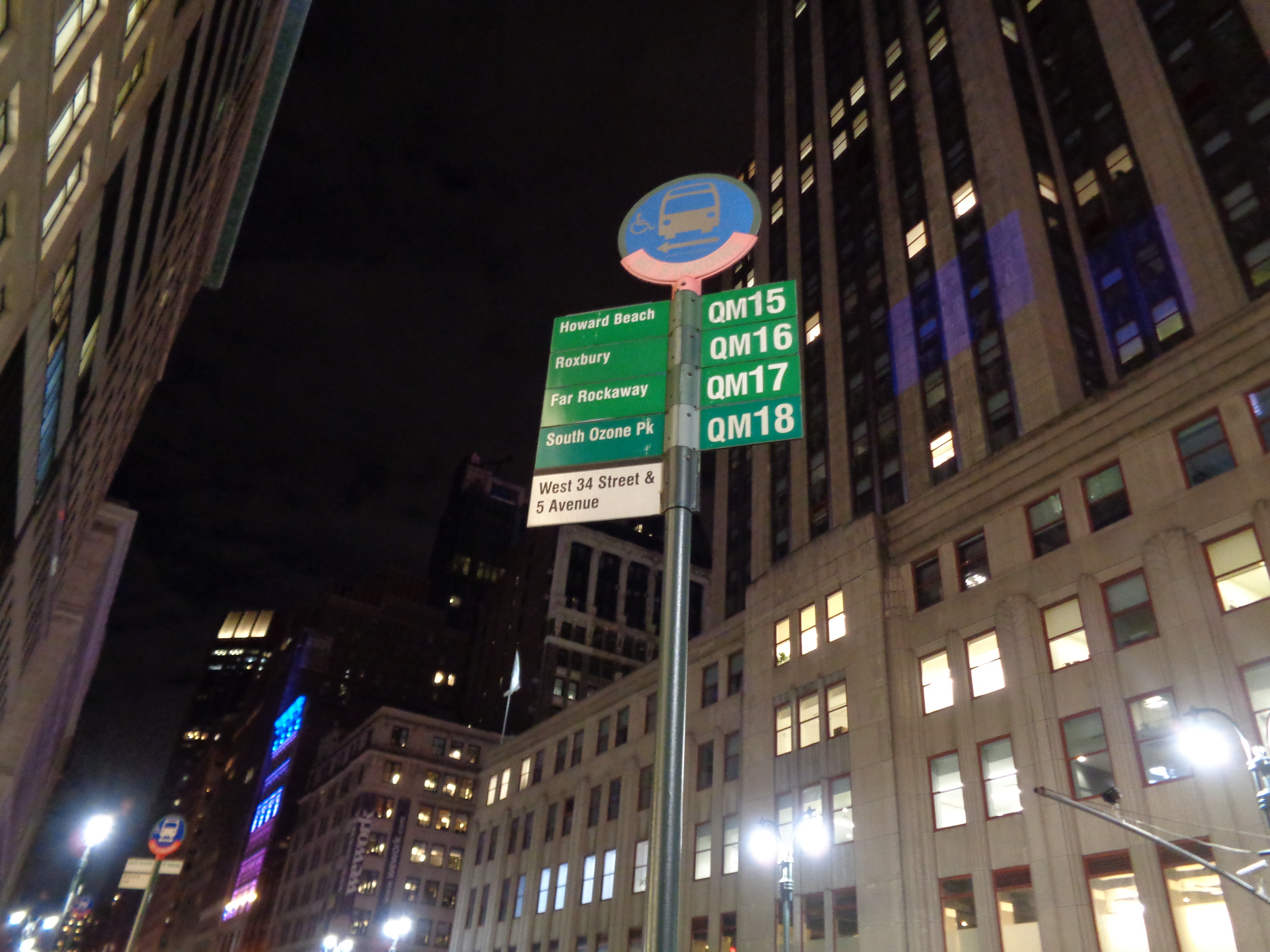
English: A bus stop for Queens-bound QM15, QM16, QM17, and QM18 buses at 34th Street between 5th and 6th Avenues, across from the Empire State Building, in Herald Square, Midtown Manhattan. Note that the bus stop states that QM16 buses go to Roxbury in the Rockaways; they actually end at Jacob Riis Park, just short of Roxbury. |
| Date | Taken on 19 November 2017, 18:53:10 |
| Source | Own work |
| Author | Tdorante10 |
| Camera location | | View this and other nearby images on: OpenStreetMap |
|---|
Licensing edit
I, the copyright holder of this work, hereby publish it under the following license:
This file is licensed under the Creative Commons Attribution-Share Alike 4.0 International license.
- You are free:
- to share – to copy, distribute and transmit the work
- to remix – to adapt the work
- Under the following conditions:
- attribution – You must give appropriate credit, provide a link to the license, and indicate if changes were made. You may do so in any reasonable manner, but not in any way that suggests the licensor endorses you or your use.
- share alike – If you remix, transform, or build upon the material, you must distribute your contributions under the same or compatible license as the original.
File history
Click on a date/time to view the file as it appeared at that time.
| Date/Time | Thumbnail | Dimensions | User | Comment | |
|---|---|---|---|---|---|
| current | 04:40, 25 March 2018 | | 5,152 × 3,864 (7.81 MB) | Tdorante10 (talk | contribs) | User created page with UploadWizard |
You cannot overwrite this file.
File usage on Commons
The following page uses this file: