File:370-RCS tow 11 image 238.jpg - ~140 km southeast of Long Island - DPLA - 69821ae64850e1a8a74e165d7e3a0b11.jpg

Size of this preview: 786 × 599 pixels. Other resolutions: 315 × 240 pixels | 629 × 480 pixels | 1,007 × 768 pixels | 1,280 × 976 pixels | 2,360 × 1,800 pixels.
Original file (2,360 × 1,800 pixels, file size: 72 KB, MIME type: image/jpeg)
Captions
Captions
Add a one-line explanation of what this file represents
Summary
edit
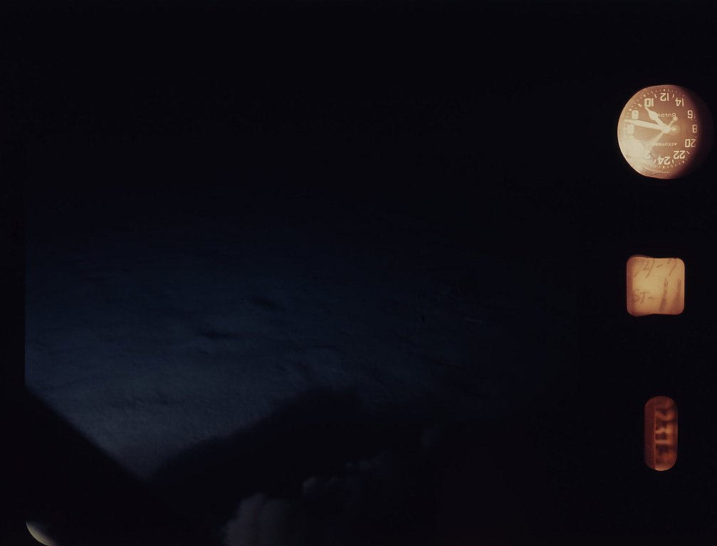
| 370-RCS_tow_11_image_238.jpg - ~140 km southeast of Long Island
( |
||||||||||||||||||||
|---|---|---|---|---|---|---|---|---|---|---|---|---|---|---|---|---|---|---|---|---|
| Creator | Department of Commerce. National Oceanic and Atmospheric Administration. National Marine Fisheries Service. Northeast Fisheries Science Center. 10/9/1970 | |||||||||||||||||||
| Title |
370-RCS_tow_11_image_238.jpg - ~140 km southeast of Long Island |
|||||||||||||||||||
| Description |
The original database described this photograph as: Tow Number: 11 Image Number: 238 Film Type: color Month: 7 Day: 11 Year: 1974 Start Latitude: 39.33 Start Longitude: 71.57 End Latitude: 39.34 End Longitude: 71.54 General Location: ~140 km southeast of Long Island Minimum Depth (Meters): 549 Maximum Depth (Meters): 549 Bottom Temperature (Celsius): 5.5 NEFSC Cruise Number: AL-7407 Vessel: Albatross IV Source: NOAA Fisheries, Northeast Fisheries Science Center, Woods Hole, Massachusetts |
|||||||||||||||||||
| Date | 11 July 1974 | |||||||||||||||||||
| Collection |
|
|||||||||||||||||||
| Source/Photographer |
|
|||||||||||||||||||
| Permission (Reusing this file) |
|
|||||||||||||||||||
| Standardized rights statement |
|
|||||||||||||||||||
File history
Click on a date/time to view the file as it appeared at that time.
| Date/Time | Thumbnail | Dimensions | User | Comment | |
|---|---|---|---|---|---|
| current | 07:56, 21 November 2020 | | 2,360 × 1,800 (72 KB) | DPLA bot (talk | contribs) | Uploading DPLA ID 69821ae64850e1a8a74e165d7e3a0b11 |
You cannot overwrite this file.
File usage on Commons
The following page uses this file: