File:3D View of Ovda Regio.jpg
Size of this preview: 800 × 600 pixels. Other resolutions: 320 × 240 pixels | 640 × 480 pixels | 1,024 × 768 pixels | 1,280 × 960 pixels | 1,600 × 1,200 pixels.
Original file (1,600 × 1,200 pixels, file size: 407 KB, MIME type: image/jpeg)
Captions
Captions
Add a one-line explanation of what this file represents
Summary
edit
| This image appeared on English Wikipedia's Main Page in the Did you know? column on 27 April 2015 (see archives). |
| Description |
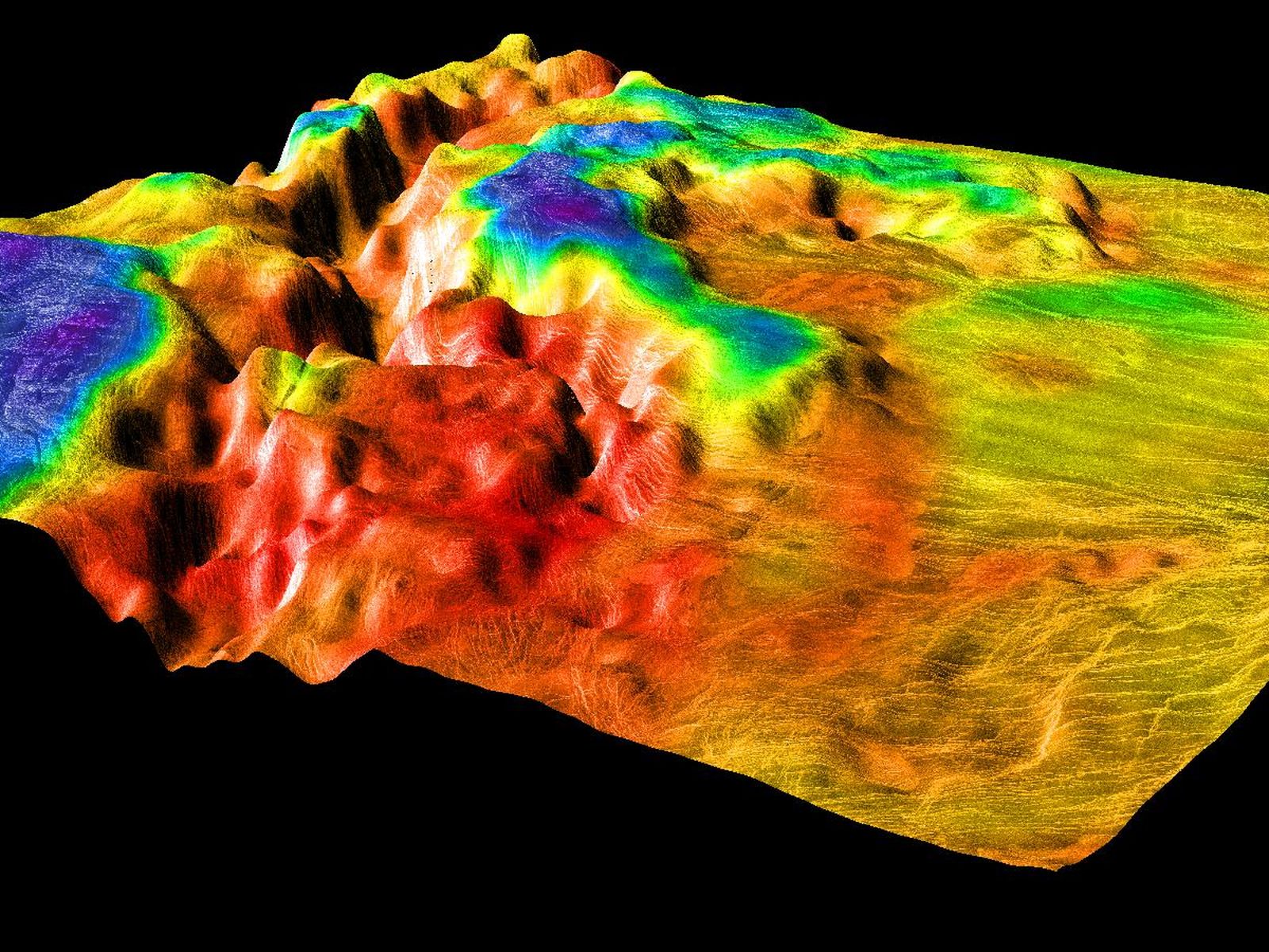
English: This 3D view depicts the border between the lowland plains on the right and the crustal plateau region of Ovda Regio on the left. This image was created using Magellan's data and organized by color with emissivity. |
| Date | |
| Source | http://www.jpl.nasa.gov/spaceimages/details.php?id=PIA00311 |
| Author | NASA/JPL/USGS |
Licensing
edit
| This file is in the public domain in the United States because it was solely created by NASA. NASA copyright policy states that "NASA material is not protected by copyright unless noted". (See Template:PD-USGov, NASA copyright policy page or JPL Image Use Policy.) | ||
 |
Warnings:
|
File history
Click on a date/time to view the file as it appeared at that time.
| Date/Time | Thumbnail | Dimensions | User | Comment | |
|---|---|---|---|---|---|
| current | 03:45, 2 March 2015 | | 1,600 × 1,200 (407 KB) | Planetarysprotege (talk | contribs) | User created page with UploadWizard |
You cannot overwrite this file.
File usage on Commons
There are no pages that use this file.
File usage on other wikis
The following other wikis use this file:
- Usage on en.wikipedia.org
- Usage on es.wikipedia.org
- Usage on nl.wikipedia.org
- Usage on uk.wikipedia.org