File:3D locations in Google Earth.svg

Size of this PNG preview of this SVG file: 800 × 406 pixels. Other resolutions: 320 × 162 pixels | 640 × 325 pixels | 1,024 × 520 pixels | 1,280 × 650 pixels | 2,560 × 1,300 pixels | 2,754 × 1,398 pixels.
Original file (SVG file, nominally 2,754 × 1,398 pixels, file size: 1.15 MB)
Captions
Captions
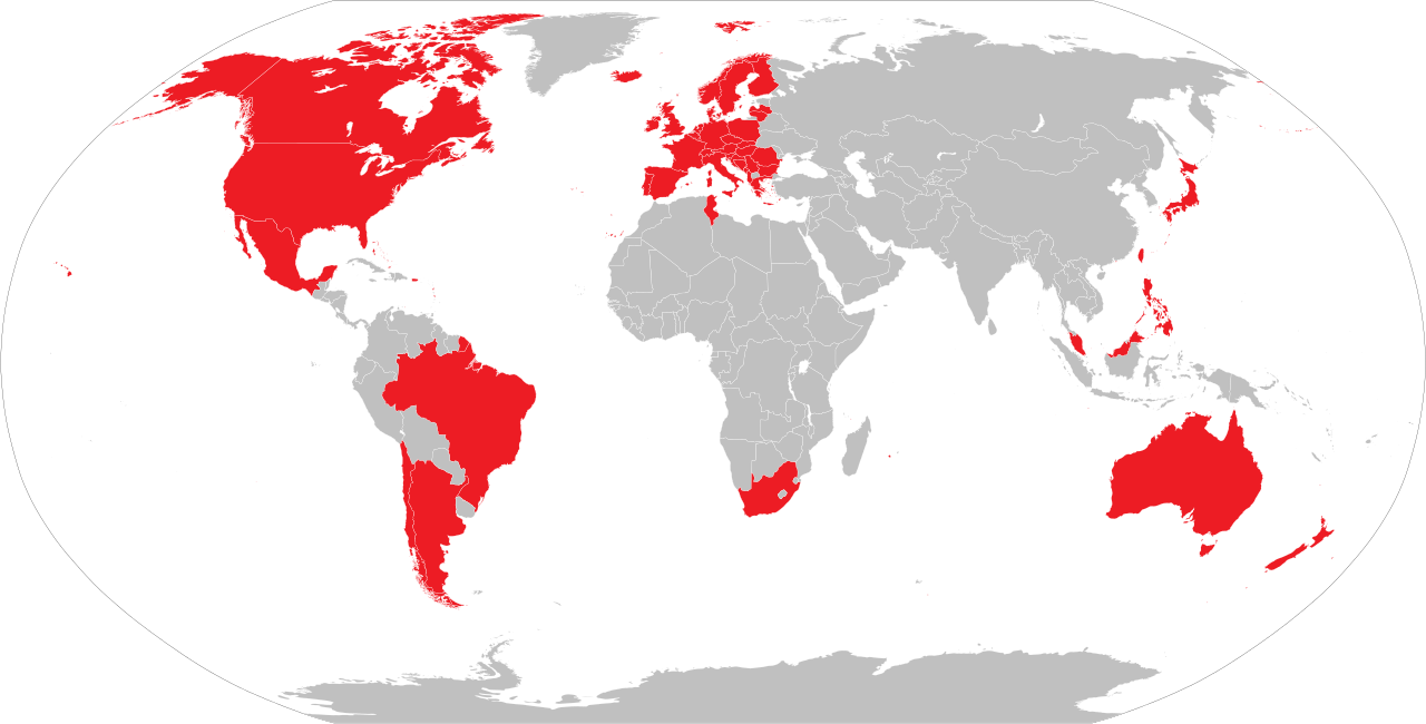
Countries and territories with 3D coverage in Google Earth
Summary
edit
| Description |
English: Countries and territories with 3D coverage in Google Earth as of May 2024.
Countries and territories with 3D coverage. Countries and territories with former 3D coverage. Countries and territories without 3D coverage. |
| Date | |
| Source | Own work |
| Author | Soumya-8974 |
| SVG development |

|
A raster version of this image is available. It should be used in place of this vector image when superior.
File:3D locations in Google Earth.svg → File:3D locations in Google Earth.png
In general, it is better to use a good SVG version. |
Licensing
edit
I, the copyright holder of this work, hereby publish it under the following license:
This file is licensed under the Creative Commons Attribution 4.0 International license.
- You are free:
- to share – to copy, distribute and transmit the work
- to remix – to adapt the work
- Under the following conditions:
- attribution – You must give appropriate credit, provide a link to the license, and indicate if changes were made. You may do so in any reasonable manner, but not in any way that suggests the licensor endorses you or your use.
File history
Click on a date/time to view the file as it appeared at that time.
| Date/Time | Thumbnail | Dimensions | User | Comment | |
|---|---|---|---|---|---|
| current | 07:55, 26 May 2024 | | 2,754 × 1,398 (1.15 MB) | GoombaKoopa (talk | contribs) | Added Albania, Iceland, Latvia and Lithuania |
| 04:18, 16 January 2022 |  | 2,754 × 1,398 (1.15 MB) | Chubit (talk | contribs) | Based on civil requests, Google Earth restores a 3D city map of Taiwan | |
| 06:08, 17 April 2021 |  | 2,754 × 1,398 (1.15 MB) | Chubit (talk | contribs) | 更新了部分國家 | |
| 09:23, 5 October 2020 |  | 2,754 × 1,398 (1.15 MB) | Sbb1413 (talk | contribs) | Uploaded own work with UploadWizard |
You cannot overwrite this file.
File usage on Commons
The following page uses this file:
File usage on other wikis
The following other wikis use this file:
- Usage on ckb.wikipedia.org
- Usage on en.wikipedia.org
- Usage on lv.wikipedia.org
- Usage on mni.wikipedia.org
- Usage on uz.wikipedia.org
- Usage on zh.wikipedia.org