File:410 extension from Mayfield to Valleywood.svg

Size of this PNG preview of this SVG file: 618 × 432 pixels. Other resolutions: 320 × 224 pixels | 640 × 447 pixels | 1,024 × 716 pixels | 1,280 × 895 pixels | 2,560 × 1,790 pixels.
Original file (SVG file, nominally 618 × 432 pixels, file size: 197 KB)
Captions
Captions
Add a one-line explanation of what this file represents
| Description |
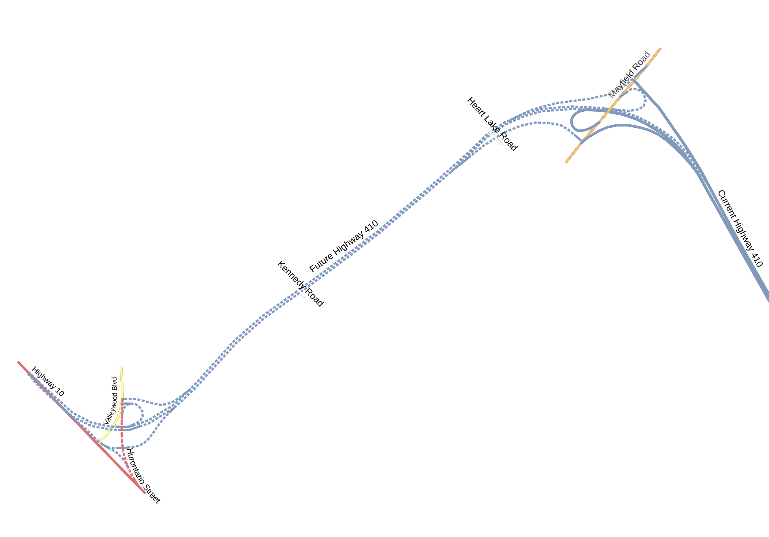
English: Rough map of Ontario Highway 410 extension under construction at the time of upload. Heavily modified Osmarender rendering of the OpenStreetMap data from the area. |
| Date | |
| Source | OpenStreetMap |
| Author | OpenStreetMap contributors |
| Permission (Reusing this file) |
This file is licensed under the Creative Commons Attribution-Share Alike 2.0 Generic license.
|
See the OpenStreetMap map of this area.
File history
Click on a date/time to view the file as it appeared at that time.
| Date/Time | Thumbnail | Dimensions | User | Comment | |
|---|---|---|---|---|---|
| current | 00:20, 29 January 2009 | | 618 × 432 (197 KB) | Psbsub (talk | contribs) | Strip nodes outside of the page. |
| 00:07, 29 January 2009 |  | 618 × 432 (199 KB) | Psbsub (talk | contribs) | Strip one-way arrows and correct Kennedy Road to unclassified Category:Maps Category:Roads in Ontario | |
| 23:53, 28 January 2009 |  | 618 × 432 (341 KB) | Psbsub (talk | contribs) | Remove unneeded styles Category:Maps Category:Roads in Ontario | |
| 21:44, 28 January 2009 |  | 618 × 432 (378 KB) | Psbsub (talk | contribs) | Convert text to paths | |
| 21:36, 28 January 2009 |  | 618 × 432 (234 KB) | Psbsub (talk | contribs) | {{Information |Description={{en|1=Rough map of Ontario Highway 410 extension under construction at the time of upload. Heavily modified Osmarender rendering of the OpenStreetMap data from the area.}} |Source=OpenStreetMap |Author=OpenStreetMap con |
You cannot overwrite this file.
File usage on Commons
There are no pages that use this file.