File:4th Artillery Aerial Observation School - Location Map.jpg

Size of this preview: 800 × 574 pixels. Other resolutions: 320 × 230 pixels | 640 × 459 pixels | 1,024 × 735 pixels | 1,280 × 918 pixels | 2,021 × 1,450 pixels.
Original file (2,021 × 1,450 pixels, file size: 456 KB, MIME type: image/jpeg)
Captions
Captions
Add a one-line explanation of what this file represents
Summary
edit
| Description |
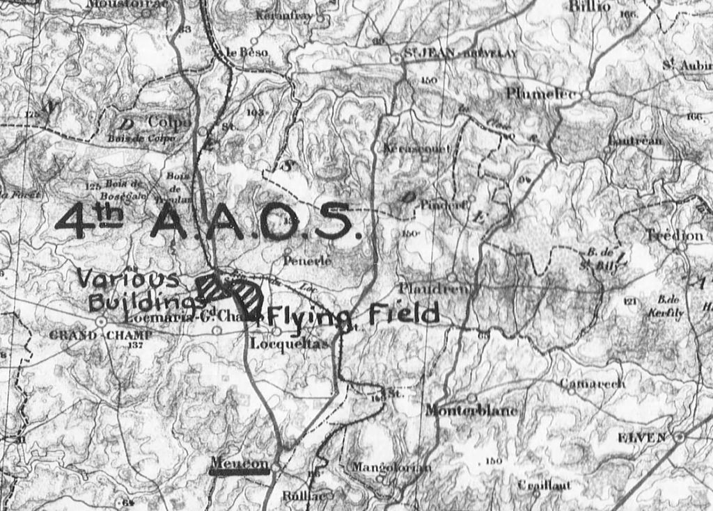
English: 4th Artillery Aerial Observation School - Location Map Locmaria-Grand-Champ (Camp De Meucon), France |
| Date | |
| Source | US National Archives, Gorrell's History of the American Expeditionary Forces Air Service, Series J Volume 10 Histories of the 5th (Bron), and 6th (Pau) Aviation Instruction Centers, Cazaux Aviation Instruction Center, St. John-de-Monts Aerial Gunnery School, 1st-5th Aerial Observation Schools, I and II Corps Aeronautical Schools, and Detachments at the Artillery Candidiates School, and French, English, and Italian Aviation Scools via http://www.fold3.com |
| Author | Air Service, United States Army |
Licensing
edit
|
This work is in the public domain in its country of origin and other countries and areas where the copyright term is the author's life plus 70 years or fewer. This work is in the public domain in the United States because it was published (or registered with the U.S. Copyright Office) before January 1, 1929. | |
| This file has been identified as being free of known restrictions under copyright law, including all related and neighboring rights. | |
File history
Click on a date/time to view the file as it appeared at that time.
| Date/Time | Thumbnail | Dimensions | User | Comment | |
|---|---|---|---|---|---|
| current | 00:43, 19 January 2015 | | 2,021 × 1,450 (456 KB) | WWIFan (talk | contribs) | User created page with UploadWizard |
You cannot overwrite this file.
File usage on Commons
The following page uses this file: