File:700 block Chestnut Philly.JPG

Size of this preview: 799 × 599 pixels. Other resolutions: 320 × 240 pixels | 640 × 480 pixels | 1,024 × 768 pixels | 1,280 × 960 pixels | 2,560 × 1,920 pixels | 3,849 × 2,887 pixels.
Original file (3,849 × 2,887 pixels, file size: 3.28 MB, MIME type: image/jpeg)
Captions
Captions
Add a one-line explanation of what this file represents
|
This is an image of a place or building that is listed on the National Register of Historic Places in the United States of America. Its reference number is 84003531. |
Summary
edit
| Description |
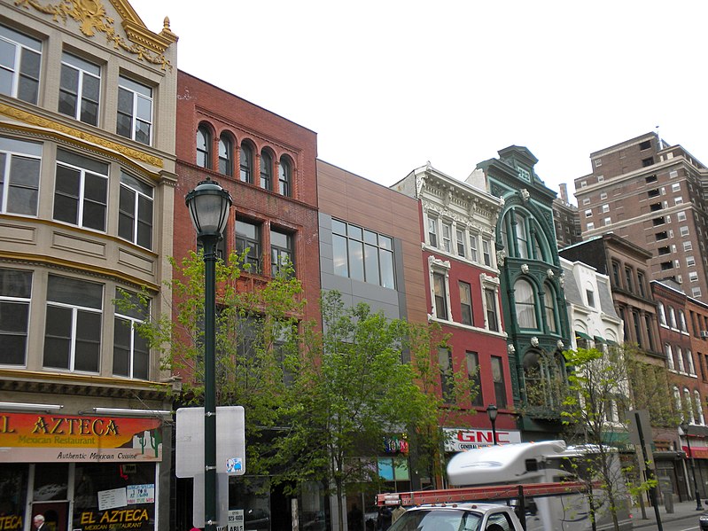
English: South side of the 700 block of Chestnut Street in Philadelphia. (Green Building is 722) This is part of the fairly large East Center City Commercial Historic District on the NRHP since July 5, 1984, on the eastern edge. The Historic District is roughly bounded by 6th (on the east) , Juniper (west), Market (west) and Locust Streets (south) in (and overflowing) the Washington Square neighborhood. Coordinates below are for 722 Chestnut. Coordinates given by NRHP for the district are 39°57′5″N 75°9′33″W |
| Date | |
| Source | Own work |
| Author | Smallbones |
| Camera location | | View this and other nearby images on: OpenStreetMap |
|---|
Licensing
edit
| I, the copyright holder of this work, release this work into the public domain. This applies worldwide. In some countries this may not be legally possible; if so: I grant anyone the right to use this work for any purpose, without any conditions, unless such conditions are required by law. |
File history
Click on a date/time to view the file as it appeared at that time.
| Date/Time | Thumbnail | Dimensions | User | Comment | |
|---|---|---|---|---|---|
| current | 12:42, 15 April 2010 | | 3,849 × 2,887 (3.28 MB) | Smallbones (talk | contribs) | {{Information |Description={{en|1=South side of the 700 block of Chestnut Street in Philadelphia. (Green Building is 722) This is part of the fairly large East Center City Commercial Historic District on the NRHP since July 5, 1984, on the eastern edge. |
You cannot overwrite this file.
File usage on Commons
There are no pages that use this file.
File usage on other wikis
The following other wikis use this file:
- Usage on en.wikipedia.org
- Usage on www.wikidata.org