File:令和元年(2019年)台風19号に関する情報・空中写真(斜め写真) ・吉田川地区 7M5A9671.jpg
(Redirected from File:7M5A9671.JPG)

Size of this preview: 800 × 533 pixels. Other resolutions: 320 × 213 pixels | 640 × 427 pixels | 1,024 × 683 pixels | 1,440 × 960 pixels.
Original file (1,440 × 960 pixels, file size: 601 KB, MIME type: image/jpeg)
Captions
Captions
Add a one-line explanation of what this file represents
Summary edit
%E5%8F%B0%E9%A2%A819%E5%8F%B7%E3%81%AB%E9%96%A2%E3%81%99%E3%82%8B%E6%83%85%E5%A0%B1%E3%83%BB%E7%A9%BA%E4%B8%AD%E5%86%99%E7%9C%9F%EF%BC%88%E6%96%9C%E3%82%81%E5%86%99%E7%9C%9F%EF%BC%89_%E3%83%BB%E5%90%89%E7%94%B0%E5%B7%9D%E5%9C%B0%E5%8C%BA_7M5A9671.jpg&action=edit§ion=1)
| Description |
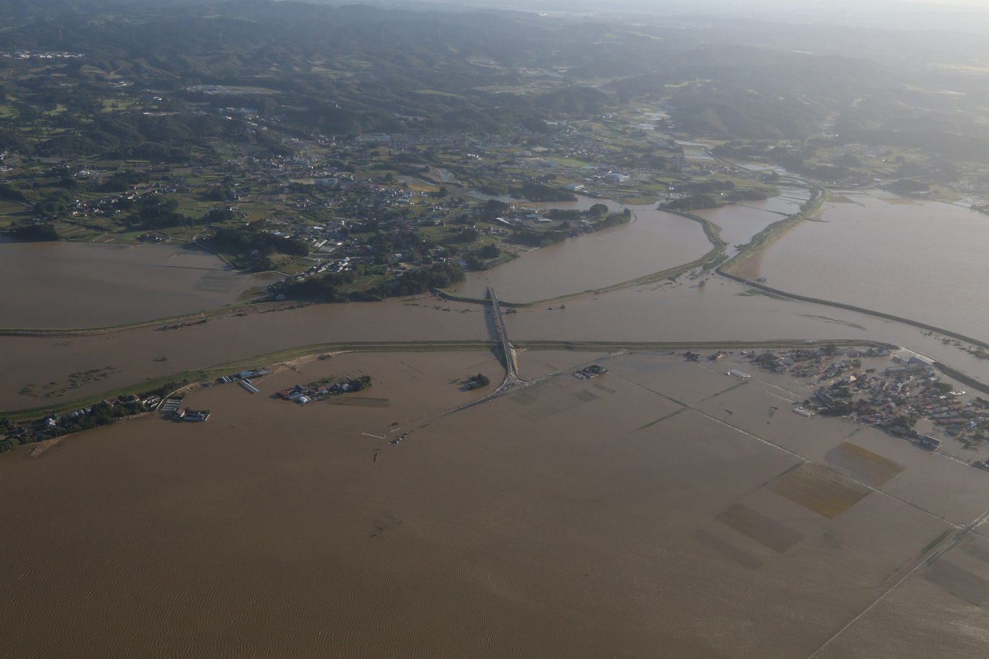
日本語: 令和元年(2019年)台風19号に関する情報・空中写真(斜め写真) ・吉田川地区 |
| Date | |
| Source | https://saigai.gsi.go.jp/1/R1_10typhoon19/1013yoshidagawa/naname/qv/7M5A9671.JPG |
| Author | 国土地理院 |
| Camera location | | View this and other nearby images on: OpenStreetMap |
|---|
%E5%8F%B0%E9%A2%A819%E5%8F%B7%E3%81%AB%E9%96%A2%E3%81%99%E3%82%8B%E6%83%85%E5%A0%B1%E3%83%BB%E7%A9%BA%E4%B8%AD%E5%86%99%E7%9C%9F%EF%BC%88%E6%96%9C%E3%82%81%E5%86%99%E7%9C%9F%EF%BC%89_%E3%83%BB%E5%90%89%E7%94%B0%E5%B7%9D%E5%9C%B0%E5%8C%BA_7M5A9671.jpg¶ms=038.451700_N_0141.002352_E_globe:Earth_type:camera_heading:69.00&language=en)
Licensing edit
%E5%8F%B0%E9%A2%A819%E5%8F%B7%E3%81%AB%E9%96%A2%E3%81%99%E3%82%8B%E6%83%85%E5%A0%B1%E3%83%BB%E7%A9%BA%E4%B8%AD%E5%86%99%E7%9C%9F%EF%BC%88%E6%96%9C%E3%82%81%E5%86%99%E7%9C%9F%EF%BC%89_%E3%83%BB%E5%90%89%E7%94%B0%E5%B7%9D%E5%9C%B0%E5%8C%BA_7M5A9671.jpg&action=edit§ion=2)

|
This work is licensed under the Government of Japan Standard Terms of Use (Ver.2.0). The Terms of Use are compatible with the Creative Commons Attribution License 4.0 International. For terms of use this work, see this license page.
|
This file is licensed under the Creative Commons Attribution 4.0 International license.
Attribution: 国土地理院 (GSI)
- You are free:
- to share – to copy, distribute and transmit the work
- to remix – to adapt the work
- Under the following conditions:
- attribution – You must give appropriate credit, provide a link to the license, and indicate if changes were made. You may do so in any reasonable manner, but not in any way that suggests the licensor endorses you or your use.
File history
Click on a date/time to view the file as it appeared at that time.
| Date/Time | Thumbnail | Dimensions | User | Comment | |
|---|---|---|---|---|---|
| current | 15:10, 14 October 2019 | | 1,440 × 960 (601 KB) | 片割れ靴下 (talk | contribs) |
You cannot overwrite this file.
File usage on Commons
The following 3 pages use this file:
- User:片割れ靴下/gallery
- File:7M5A9671.JPG (file redirect)
台風19号に関する情報・空中写真(斜め写真)_・吉田川地区_7M5A9671.jpg&oldid=713102575)