File:8 Chestnut Road - geograph.org.uk - 1750977.jpg
Size of this preview: 585 × 600 pixels. Other resolutions: 234 × 240 pixels | 624 × 640 pixels.
Original file (624 × 640 pixels, file size: 162 KB, MIME type: image/jpeg)
Captions
Captions
Add a one-line explanation of what this file represents
Summary
edit
| Description |
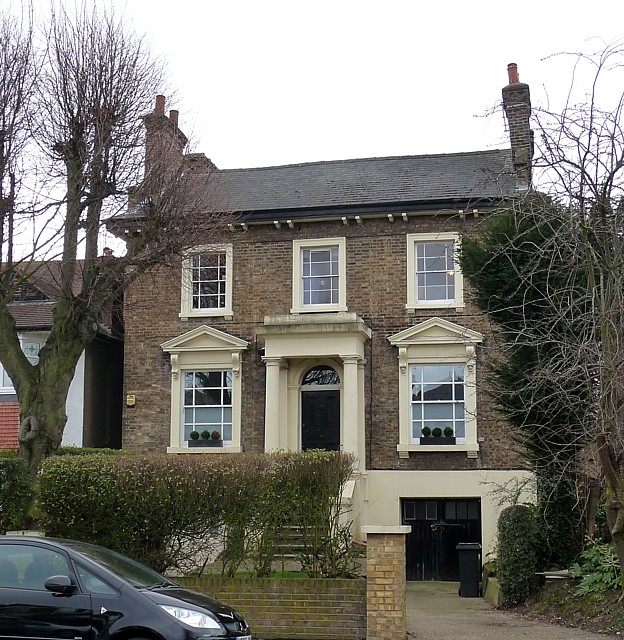
English: 8 Chestnut Road One of a few attractive mid-C19th villas in the road within the West Norwood Conservation Area.
The development of West Norwood began with the breaking up of Lord Thurlow's estate after his death in 1806. Much of this initial phase has since been swept away by subsequent development which accelerated over the second half of the C19th and during the C20th, but there are pockets of houses surviving from the early days, mostly around Knights Hill, Norwood High Street/Elder Road and the area between them. |
| Date | |
| Source | From geograph.org.uk |
| Author | Stephen Richards |
| Attribution (required by the license) | Stephen Richards / 8 Chestnut Road / |
| Camera location | | View this and other nearby images on: OpenStreetMap |
|---|
_heading:135.00&language=en)
| Object location | | View this and other nearby images on: OpenStreetMap |
|---|
_heading:135.00&language=en)
Licensing
edit

|
This image was taken from the Geograph project collection. See this photograph's page on the Geograph website for the photographer's contact details. The copyright on this image is owned by Stephen Richards and is licensed for reuse under the Creative Commons Attribution-ShareAlike 2.0 license.
|
This file is licensed under the Creative Commons Attribution-Share Alike 2.0 Generic license.
Attribution: Stephen Richards
- You are free:
- to share – to copy, distribute and transmit the work
- to remix – to adapt the work
- Under the following conditions:
- attribution – You must give appropriate credit, provide a link to the license, and indicate if changes were made. You may do so in any reasonable manner, but not in any way that suggests the licensor endorses you or your use.
- share alike – If you remix, transform, or build upon the material, you must distribute your contributions under the same or compatible license as the original.
File history
Click on a date/time to view the file as it appeared at that time.
| Date/Time | Thumbnail | Dimensions | User | Comment | |
|---|---|---|---|---|---|
| current | 21:45, 5 March 2011 | | 624 × 640 (162 KB) | GeographBot (talk | contribs) | == {{int:filedesc}} == {{Information |description={{en|1=8 Chestnut Road One of a few attractive mid-C19th villas in the road within the West Norwood Conservation Area. The development of West Norwood began with the breaking up of Lord Thurlow's estate a |
You cannot overwrite this file.
File usage on Commons
There are no pages that use this file.