File:A100 Geplanter Ausbau.png
Size of this preview: 360 × 599 pixels. Other resolutions: 144 × 240 pixels | 288 × 480 pixels | 461 × 768 pixels | 1,215 × 2,022 pixels.
Original file (1,215 × 2,022 pixels, file size: 2.51 MB, MIME type: image/png)
Captions
Captions
Add a one-line explanation of what this file represents
Summary edit
| Description |
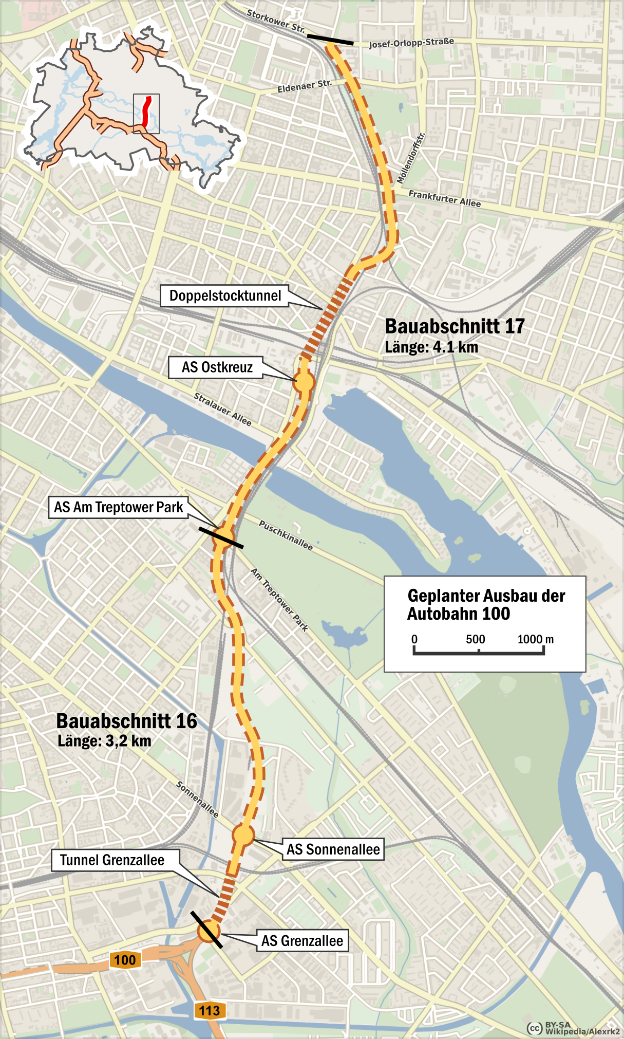
Deutsch: Geplanter Ausbau der Bundesautobahn 100: Bauabschnitt 16 und 17 |
|||
| Date | ||||
| Source |
own work, using |
|||
| Author | Alexrk2 | |||
| Permission (Reusing this file) |
|
Licensing edit
I, the copyright holder of this work, hereby publish it under the following license:
This file is licensed under the Creative Commons Attribution-Share Alike 3.0 Unported license.
- You are free:
- to share – to copy, distribute and transmit the work
- to remix – to adapt the work
- Under the following conditions:
- attribution – You must give appropriate credit, provide a link to the license, and indicate if changes were made. You may do so in any reasonable manner, but not in any way that suggests the licensor endorses you or your use.
- share alike – If you remix, transform, or build upon the material, you must distribute your contributions under the same or compatible license as the original.
File history
Click on a date/time to view the file as it appeared at that time.
| Date/Time | Thumbnail | Dimensions | User | Comment | |
|---|---|---|---|---|---|
| current | 12:20, 16 May 2016 | | 1,215 × 2,022 (2.51 MB) | Alexrk2 (talk | contribs) | Legende aufgelöst |
| 15:46, 15 May 2016 |  | 1,215 × 2,022 (2.51 MB) | Alexrk2 (talk | contribs) | Zusatzplanung aus 2013 für den nördlichen Teil des BA 17, aktuelle Kartengrundlage aus 2016 | |
| 09:34, 7 October 2011 |  | 774 × 870 (617 KB) | Alexrk2 (talk | contribs) | - | |
| 21:26, 6 October 2011 |  | 772 × 868 (615 KB) | Alexrk2 (talk | contribs) | - | |
| 21:13, 6 October 2011 |  | 776 × 872 (612 KB) | Alexrk2 (talk | contribs) | == Summary == {{Information |Description={{de|Geplanter Ausbau der Bundesautobahn 100: Bauabschnitt 16 und 17}} |Source=own work, using * [http://www.openstreetmap.org Openstreetmap] data |Date=2011-10 |Author=[[:de:Benutzer:Ale |
You cannot overwrite this file.
File usage on Commons
The following 3 pages use this file:
File usage on other wikis
The following other wikis use this file:
- Usage on de.wikipedia.org