File:ACW Western Theater Overview.png

Size of this preview: 800 × 600 pixels. Other resolutions: 320 × 240 pixels | 640 × 480 pixels | 1,024 × 768 pixels | 1,280 × 960 pixels | 2,560 × 1,920 pixels | 3,000 × 2,250 pixels.
Original file (3,000 × 2,250 pixels, file size: 2.3 MB, MIME type: image/png)
Captions
Captions
Add a one-line explanation of what this file represents
Summary
edit
| Description |
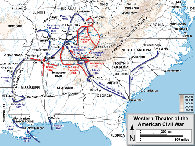
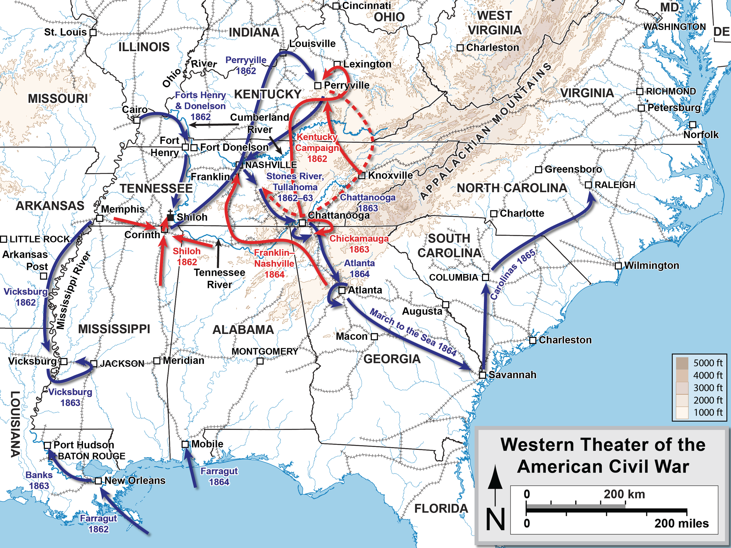
English: Map 1 of 5 of the Western theater of the American Civil War. Drawn by Hal Jespersen in Adobe Illustrator CS5. Graphic source file is available at http://cwmaps.com/
This file is licensed under the Creative Commons Attribution 3.0 Unported license. Attribution: Map by Hal Jespersen, www.cwmaps.com
|
| Date | |
| Source | Own work |
| Author | Hal Jespersen |
Licensing
edit
I, the copyright holder of this work, hereby publish it under the following license:
This file is licensed under the Creative Commons Attribution-Share Alike 3.0 Unported license.
- You are free:
- to share – to copy, distribute and transmit the work
- to remix – to adapt the work
- Under the following conditions:
- attribution – You must give appropriate credit, provide a link to the license, and indicate if changes were made. You may do so in any reasonable manner, but not in any way that suggests the licensor endorses you or your use.
- share alike – If you remix, transform, or build upon the material, you must distribute your contributions under the same or compatible license as the original.
File history
Click on a date/time to view the file as it appeared at that time.
| Date/Time | Thumbnail | Dimensions | User | Comment | |
|---|---|---|---|---|---|
| current | 16:36, 31 October 2016 | | 3,000 × 2,250 (2.3 MB) | Hlj (talk | contribs) | Fixed incorrect date for Franklin–Nashville. Same license. |
| 22:07, 26 January 2015 |  | 3,000 × 2,250 (2.3 MB) | Hlj (talk | contribs) | Reverted back to the hypsometric topographic style used by most of my ACW maps. Improved the accuracy of locations, rivers, and railroads. Same license. | |
| 20:57, 19 January 2012 |  | 2,407 × 1,889 (6.89 MB) | Hlj (talk | contribs) | Correct typo. Same license. | |
| 21:56, 26 December 2011 |  | 2,407 × 1,889 (6.54 MB) | Hlj (talk | contribs) |
You cannot overwrite this file.
File usage on Commons
The following page uses this file:
File usage on other wikis
The following other wikis use this file:
- Usage on ar.wikipedia.org
- Usage on en.wikipedia.org
- Usage on en.wikibooks.org
- Usage on fa.wikipedia.org
- Usage on fr.wikipedia.org
- Usage on he.wikipedia.org
- Usage on it.wikipedia.org
- Usage on pt.wikipedia.org
- Usage on ru.wikipedia.org