File:AERIAL VIEW OF TEL MEGIDDO (7723470910).jpg
Size of this preview: 800 × 533 pixels. Other resolutions: 320 × 213 pixels | 640 × 427 pixels | 1,024 × 682 pixels | 1,280 × 853 pixels | 2,560 × 1,706 pixels | 3,508 × 2,338 pixels.
Original file (3,508 × 2,338 pixels, file size: 8.09 MB, MIME type: image/jpeg)
Captions
Captions
Add a one-line explanation of what this file represents
Summary edit
.jpg&action=edit§ion=1)
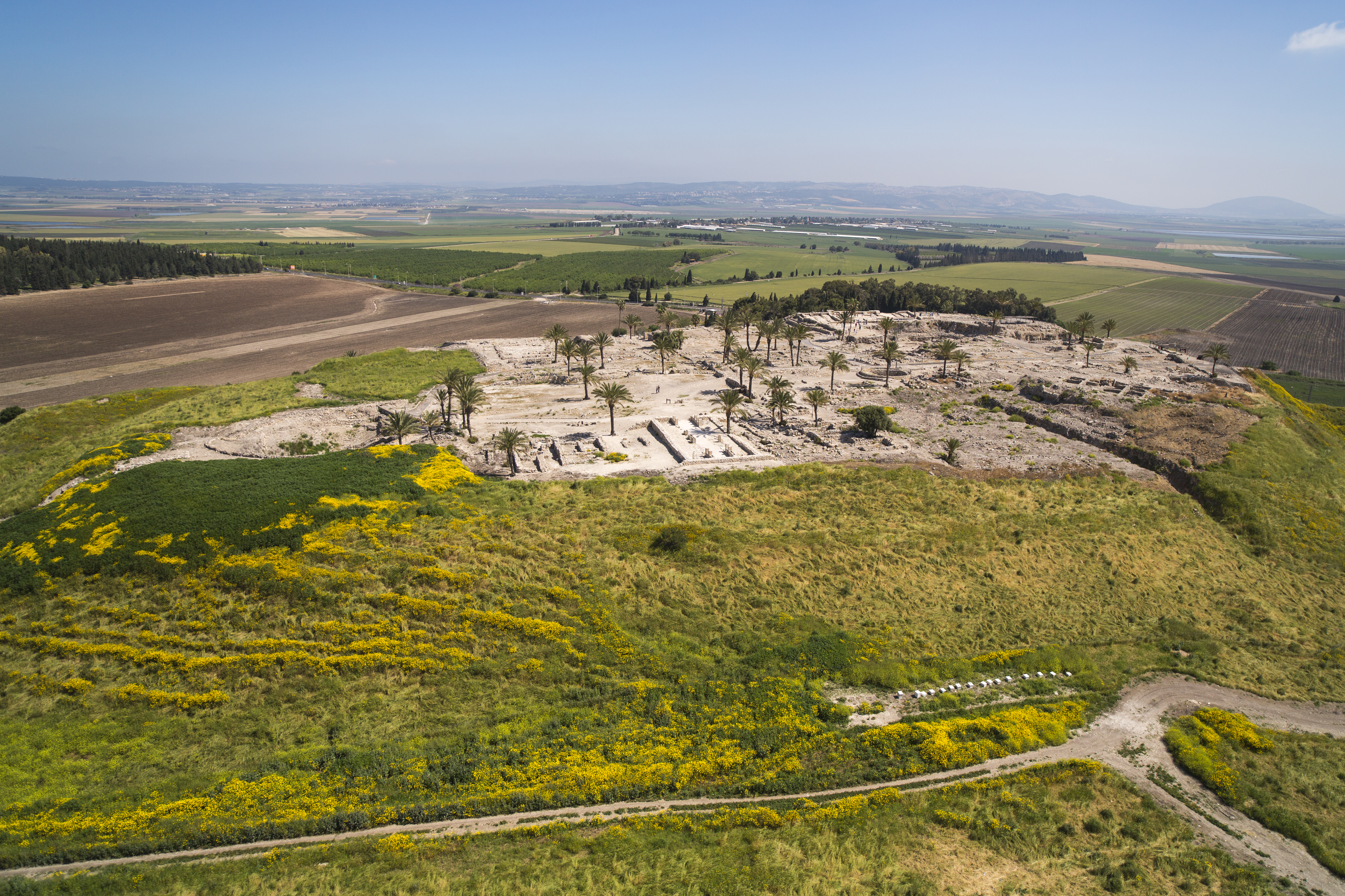
| Description | Megiddo, or Tel Megiddo, is the site of an ancient city in northern Israel's Jezreel valley. It is believed to be the place where the battle of Armageddon will be fought. The picture shows an aerial view of Tel Megiddo. Photo by Itamar Grinberg. |
| Date | |
| Source | AERIAL VIEW OF TEL MEGIDDO |
| Author | israeltourism from Israel |
Licensing edit
.jpg&action=edit§ion=2)
This file is licensed under the Creative Commons Attribution-Share Alike 2.0 Generic license.
- You are free:
- to share – to copy, distribute and transmit the work
- to remix – to adapt the work
- Under the following conditions:
- attribution – You must give appropriate credit, provide a link to the license, and indicate if changes were made. You may do so in any reasonable manner, but not in any way that suggests the licensor endorses you or your use.
- share alike – If you remix, transform, or build upon the material, you must distribute your contributions under the same or compatible license as the original.
| This image was originally posted to Flickr by israeltourism at https://www.flickr.com/photos/59838910@N06/7723470910. It was reviewed on 24 November 2014 by FlickreviewR and was confirmed to be licensed under the terms of the cc-by-sa-2.0. |
File history
Click on a date/time to view the file as it appeared at that time.
| Date/Time | Thumbnail | Dimensions | User | Comment | |
|---|---|---|---|---|---|
| current | 19:22, 24 November 2014 | | 3,508 × 2,338 (8.09 MB) | ויקיג'אנקי (talk | contribs) | Transferred from Flickr via Flickr2Commons |
You cannot overwrite this file.
File usage on Commons
There are no pages that use this file.
File usage on other wikis
The following other wikis use this file:
- Usage on en.wikivoyage.org
.jpg&oldid=835119322)