File:AMH-4191-NA Map of the fort and city of Negombo.jpg
Size of this preview: 413 × 599 pixels. Other resolutions: 165 × 240 pixels | 331 × 480 pixels | 529 × 768 pixels | 706 × 1,024 pixels | 1,654 × 2,400 pixels.
Original file (1,654 × 2,400 pixels, file size: 693 KB, MIME type: image/jpeg)
Captions
Captions
Add a one-line explanation of what this file represents
Summary
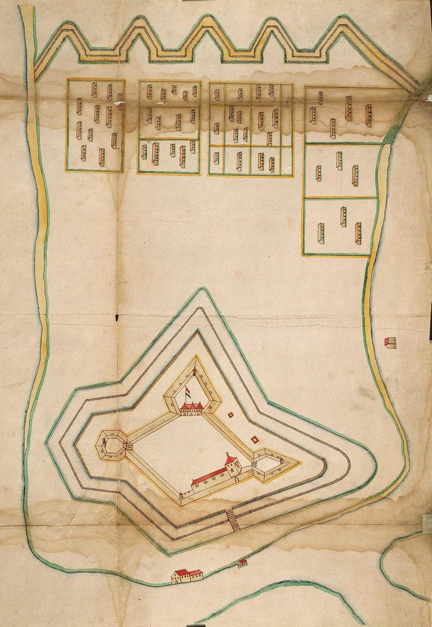
editNederlands: Plattegrond van het fort en de stad Negombo
English: Map of the fort and city of Negombo( |
||||||||||||||||||||||||
|---|---|---|---|---|---|---|---|---|---|---|---|---|---|---|---|---|---|---|---|---|---|---|---|---|
| Author |
Nederlands: Anoniem / Anonymous
English: Anoniem / Anonymous |
|||||||||||||||||||||||
| Title |
Nederlands: Plattegrond van het fort en de stad Negombo
English: Map of the fort and city of Negombo |
|||||||||||||||||||||||
| Description |
Nederlands: Titel catalogus Leupe (NA): Teekening van het Fort en Stad Negombo.
Met perforaties. Notities verso: Portefeuille 1658 I papieren van Alg [onleesbaar] Batavia. Het fort Negombo 543a ; nr. 84 [of 118?] 31.English: According to the Leupe catalogue (NA), the original title reads: Teekening van het Fort en Stad Negombo.
With perforations. Notes on reverse: Portefeuille 1658 I papieren van Alg [illegible] Batavia. Het fort Negombo 543a ; nr. 84 [or 118?] 31. |
|||||||||||||||||||||||
| Date | circa 1658 | |||||||||||||||||||||||
| Medium |
Nederlands: ingekleurde tekening op papier
English: coloured drawing on paper |
|||||||||||||||||||||||
| Dimensions | height: 72 cm (28.3 in); width: 51 cm (20 in) | |||||||||||||||||||||||
| Collection |
|
|||||||||||||||||||||||
| Accession number |
NL-HaNA_4.VEL_988 (old number: VEL0988) |
|||||||||||||||||||||||
| Inscriptions |
-
|
|||||||||||||||||||||||
| Notes |
English: Subjects: chart / map / plan, church / parsonage, fortification, house
Nederlands: Onderwerpen: plattegrond / kaart, kerk / pastorie, vesting, huis / woonhuis
English: Post: this image is related to a VOC trading post called Negombo |
|||||||||||||||||||||||
| Source/Photographer |
|
|||||||||||||||||||||||
| Permission (Reusing this file) |
|
|||||||||||||||||||||||

| Object location | | View this and other nearby images on: OpenStreetMap |
|---|
File history
Click on a date/time to view the file as it appeared at that time.
| Date/Time | Thumbnail | Dimensions | User | Comment | |
|---|---|---|---|---|---|
| current | 16:16, 10 June 2014 | | 1,654 × 2,400 (693 KB) | HuskyBot (talk | contribs) | == {{int:filedesc}} == {{Artwork |title = {{nl|1=Plattegrond van het fort en de stad Negombo}} {{en|1=Map of the fort and city of Negombo}} |description = {{nl|1=Titel catalogus Leupe (NA): ''Teekening van het... |
You cannot overwrite this file.
File usage on Commons
The following page uses this file: