File:AMH-5104-NA Map of Lagoa Bay.jpg

Original file (1,741 × 2,400 pixels, file size: 577 KB, MIME type: image/jpeg)
Captions
Captions
Summary edit
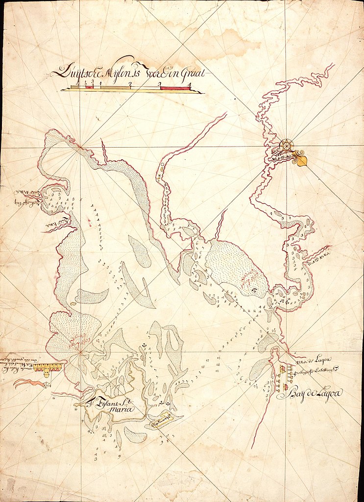
Nederlands: Kaart van baai Lagoa
English: Map of Lagoa Bay( |
||||||||||||||||||||||||
|---|---|---|---|---|---|---|---|---|---|---|---|---|---|---|---|---|---|---|---|---|---|---|---|---|
| Author |
Nederlands: Jacob de Bucquoij (landmeter / kaartenmaker)
English: Jacob de Bucquoij (land surveyor / mapmaker) |
|||||||||||||||||||||||
| Title |
Nederlands: Kaart van baai Lagoa
English: Map of Lagoa Bay |
|||||||||||||||||||||||
| Description |
Nederlands: Titel in catalogus Leupe (Nationaal Archief): Kaart van Bay de la Goa, benevens het eiland St. Maria.
De situatie is blijkbaar opgenomen op het moment dat Delagoa nog door Portugezen bezet is; in 1721 wordt door de Nederlanders fort Lijdzaamheid ingericht. Notities verso: 199 [in rood potlood].English: Title in Leupe catalogue (National Archives): Kaart van Bay de la Goa, benevens het eiland St. Maria.
The map appears to record the situation as it was when Delagoa was still in Portuguese hands; in 1721 the Dutch established Fort Lijdzaamheid. Notes on reverse: 199 [in red pencil]. |
|||||||||||||||||||||||
| Date | circa 1721 | |||||||||||||||||||||||
| Medium |
Nederlands: ingekleurde tekening op papier
English: coloured drawing on paper |
|||||||||||||||||||||||
| Dimensions | height: 53 cm (20.8 in); width: 74.5 cm (29.3 in) | |||||||||||||||||||||||
| Collection |
|
|||||||||||||||||||||||
| Accession number |
NL-HaNA_4.VEL_199 (old number: VEL0199) |
|||||||||||||||||||||||
| Inscriptions |
-
|
|||||||||||||||||||||||
| Notes |
English: Subjects: chart / map / plan, building
Nederlands: Onderwerpen: plattegrond / kaart, gebouw
English: Post: this image is related to a VOC trading post called Maputo |
|||||||||||||||||||||||
| Source/Photographer |
|
|||||||||||||||||||||||
| Permission (Reusing this file) |
|
|||||||||||||||||||||||


| Object location | | View this and other nearby images on: OpenStreetMap |
|---|
File history
Click on a date/time to view the file as it appeared at that time.
| Date/Time | Thumbnail | Dimensions | User | Comment | |
|---|---|---|---|---|---|
| current | 17:18, 10 June 2014 | | 1,741 × 2,400 (577 KB) | HuskyBot (talk | contribs) | == {{int:filedesc}} == {{Artwork |title = {{nl|1=Kaart van baai Lagoa}} {{en|1=Map of Lagoa Bay}} |description = {{nl|1=Titel in catalogus Leupe (Nationaal Archief): ''Kaart van Bay de la Goa, benevens het eila... |
You cannot overwrite this file.
File usage on Commons
The following page uses this file:
File usage on other wikis
The following other wikis use this file:
- Usage on fr.wikipedia.org