File:AMH-5160-NA Map of the Ganges river.jpg

Size of this preview: 800 × 564 pixels. Other resolutions: 320 × 226 pixels | 640 × 451 pixels | 1,024 × 722 pixels | 1,280 × 903 pixels | 2,400 × 1,693 pixels.
Original file (2,400 × 1,693 pixels, file size: 447 KB, MIME type: image/jpeg)
Captions
Captions
Add a one-line explanation of what this file represents
Summary
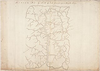
edit| Title |
Nederlands: Kaart van de rivier Ganges
English: Map of the Ganges river |
|||||||||||||||||||||||
| Description |
Nederlands: Titel in catalogus Leupe (Nationaal Archief): Kaart van de Rivier de Ganges getrocken uyt een Moorsche Kaart.
Randen geplakt, daardoor nummer rechtsboven onleesbaar. Notities verso: N2: 56English: Title in the Leupe catalogue (National Archives): Kaart van de Rivier de Ganges getrocken uyt een Moorsche Kaart.
Edges have been pasted, rendering the number top right illegible. Notes on reverse: N2: 56 |
|||||||||||||||||||||||
| Date | between 1690 and 1743 | |||||||||||||||||||||||
| Source |
|
|||||||||||||||||||||||
| Permission (Reusing this file) |
|
|||||||||||||||||||||||
| Georeferencing | If inappropriate please set warp_status = skip to hide. | |||||||||||||||||||||||
| Archival data | ||||||||||||||||||||||||
| Collection |
|
|||||||||||||||||||||||
| Accession number |
NL-HaNA_4.VEL_259 (old number: VEL0259) |
|||||||||||||||||||||||
| Dimensions | height: 74.5 cm (29.3 in); width: 52.5 cm (20.6 in) | |||||||||||||||||||||||
| Medium |
Nederlands: pen op papier
English: pen on paper |
|||||||||||||||||||||||
| Inscriptions |
Rivier de Ganges Getrocken uyt een Moorsche Kaart
|
|||||||||||||||||||||||
| Notes |
English: Subjects: chart / map / plan
Nederlands: Onderwerpen: plattegrond / kaart
English: Post: this image is related to a VOC trading post called Chunchura |
|||||||||||||||||||||||

| Object location | | View this and other nearby images on: OpenStreetMap |
|---|
File history
Click on a date/time to view the file as it appeared at that time.
| Date/Time | Thumbnail | Dimensions | User | Comment | |
|---|---|---|---|---|---|
| current | 17:29, 10 June 2014 | | 2,400 × 1,693 (447 KB) | HuskyBot (talk | contribs) | == {{int:filedesc}} == {{Artwork |title = {{nl|1=Kaart van de rivier Ganges}} {{en|1=Map of the Ganges river}} |description = {{nl|1=Titel in catalogus Leupe (Nationaal Archief): ''Kaart van de Rivier de Ganges... |
You cannot overwrite this file.
File usage on Commons
There are no pages that use this file.