File:AMH-5205-NA Chart showing landfalls of Madagascar.jpg
Original file (2,400 × 990 pixels, file size: 360 KB, MIME type: image/jpeg)
Captions
Captions
Summary edit
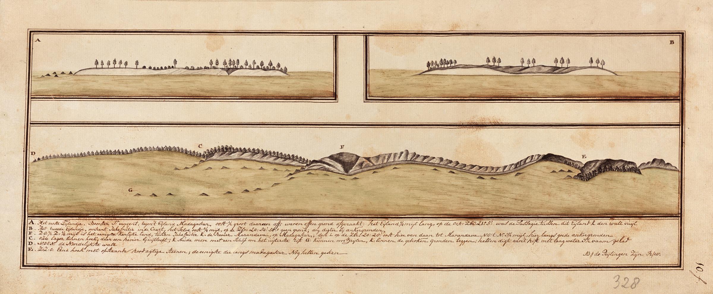
Nederlands: Kaart met landverkenningen van Madagascar
English: Chart showing landfalls of Madagascar( |
||||||||||||||||||||||||
|---|---|---|---|---|---|---|---|---|---|---|---|---|---|---|---|---|---|---|---|---|---|---|---|---|
| Author |
Nederlands: Godlob Silo (landmeter / kaartenmaker)
English: Godlob Silo (land surveyor / mapmaker) |
|||||||||||||||||||||||
| Title |
Nederlands: Kaart met landverkenningen van Madagascar
English: Chart showing landfalls of Madagascar |
|||||||||||||||||||||||
| Description |
Nederlands: Titel in catalogus Leupe (Nationaal Archief): Landverkenningen als voren, hiermee wordt bedoeld de titel van VEL0327: Landverkenningen van het Eiland Madagascar, benevens een kaartje van het Eiland Annossoway voor de Baay St. Augustyn.
Rechtsonder genummerd: 10.f.. Aan de bovenkant is een strook papier geplakt van 4,5 x 43,5 cm. Notities verso: N 126 [in potlood]. Legenda: A-EEnglish: Title in the Leupe catalogue (National Archives): Landverkenningen als voren, 'Landfalls as before', referring to the title of VEL0327: Landverkenningen van het Eiland Madagascar, benevens een kaartje van het Eiland Annossoway voor de Baay St. Augustyn.
Numbered bottom right: 10.f.. A strip of paper measurig 4.5 by 43.5 cm has been pasted along the top edge. Notes on reverse: N 126 [in pencil]. Key: A-E. |
|||||||||||||||||||||||
| Date | circa 1754 | |||||||||||||||||||||||
| Medium |
Nederlands: ingekleurde tekening op papier
English: coloured drawing on paper |
|||||||||||||||||||||||
| Dimensions | height: 44 cm (17.3 in); width: 22.5 cm (8.8 in) | |||||||||||||||||||||||
| Collection |
|
|||||||||||||||||||||||
| Accession number |
NL-HaNA_4.VEL_328C (old number: VEL0328C) |
|||||||||||||||||||||||
| Inscriptions |
-
|
|||||||||||||||||||||||
| Notes |
English: Subjects: key, flora, chart / map / plan, banderole / cartouche / ornamentation
Nederlands: Onderwerpen: legenda, flora, plattegrond / kaart, banderol / cartouche / versiering |
|||||||||||||||||||||||
| Source/Photographer |
|
|||||||||||||||||||||||
| Permission (Reusing this file) |
|
|||||||||||||||||||||||

File history
Click on a date/time to view the file as it appeared at that time.
| Date/Time | Thumbnail | Dimensions | User | Comment | |
|---|---|---|---|---|---|
| current | 17:37, 10 June 2014 | | 2,400 × 990 (360 KB) | HuskyBot (talk | contribs) | == {{int:filedesc}} == {{Artwork |title = {{nl|1=Kaart met landverkenningen van Madagascar}} {{en|1=Chart showing landfalls of Madagascar}} |description = {{nl|1=Titel in catalogus Leupe (Nationaal Archief): ''... |
You cannot overwrite this file.
File usage on Commons
The following page uses this file: