File:AMH-5587-NA Map of Samarang.jpg

Original file (2,400 × 1,602 pixels, file size: 819 KB, MIME type: image/jpeg)
Captions
Captions
Summary
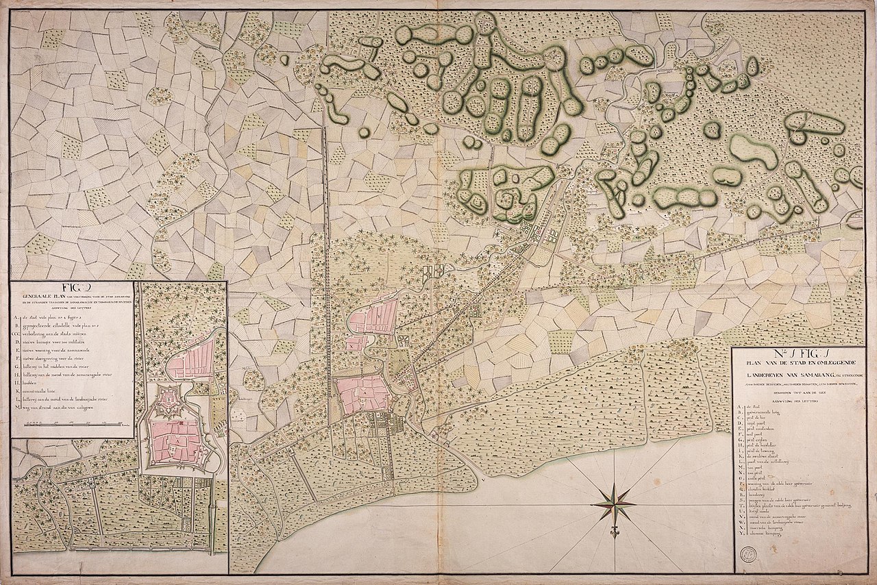
editNederlands: Kaart van Samarang
                     English:  Map of Samarang
                     Bahasa Indonesia:  Peta Semarang
( |
||||||||||||||||||||||||
|---|---|---|---|---|---|---|---|---|---|---|---|---|---|---|---|---|---|---|---|---|---|---|---|---|
| Author |
Nederlands: Anoniem / Anonymous (landmeter / kaartenmaker)
English: Anoniem / Anonymous (land surveyor / mapmaker) |
|||||||||||||||||||||||
| Title |
Nederlands: Kaart van Samarang
English: Map of Samarang
Bahasa Indonesia: Peta Semarang |
|||||||||||||||||||||||
| Description |
Nederlands: Titel catalogus Leupe (NA): Plan van de stad en omleggende landeryen van Samarang, sig strekkende 1200 Roeden Bezuyden, 1085 R. Beoosten, 1570 R. Bewesten, Benoorden tot aan Zee.
Bijzonderheden: het formaat is exclusief een strook Japans papier van 3-4 cm aan alle vier de kanten. Notities verso: Plan No. 1 voor Samarang. [twee keer] / 20 septembre 1787 / No. 17 Stad en omliggende Situatie van Samarang. Register 2, Deel 1, Folio 7, Portefeuille.. [geschreven op een blauw etiket] / 630 [met vette cijfers gestempeld op een etiketje].English: Title in the Leupe catalogue (NA): Plan van de stad en omleggende landeryen van Samarang, sig strekkende 1200 Roeden Bezuyden, 1085 R. Beoosten, 1570 R. Bewesten, Benoorden tot aan Zee.
Particulars: the measurements of the map do not include a stroke of Japanese paper of 3-4 cm pasted along all four sides. Notes on reverse: Plan No. 1 voor Samarang. [twice] / 20 septembre 1787 / No. 17 Stad en omliggende Situatie van Samarang. Register 2, Deel 1, Folio 7, Portefeuille.. [inscribed on a blue label] / 630 [stamped in bold on a small label].Bahasa Indonesia: Judul dalam katalog Leupe (AN): Plan van de stad en omleggende landeryen van Samarang, sig strekkende 1200 Roeden Bezuyden, 1085 R. Beoosten, 1570 R. Bewesten, Benoorden tot aan Zee.
Terkhusus: pengukuran peta tidak termasuk coretan kertas Jepang 3-4 cm yang ditempel di keempat sisinya. Catatan di belakang: Plan No. 1 voor Samarang. [dua kali] / 20 septembre 1787 / No. 17 Stad en omliggende Situatie van Samarang. Register 2, Deel 1, Folio 7, Portefeuille.. [ditulis pada label biru] / 630 [dicetak tebal pada label kecil]. |
|||||||||||||||||||||||
| Date | 1787 | |||||||||||||||||||||||
| Medium |
Nederlands: ingekleurde tekening op papier
English: coloured drawing on paper
Bahasa Indonesia: gambar berwarna di atas kertas |
|||||||||||||||||||||||
| Dimensions | height: 127.5 cm (50.1 in); width: 86 cm (33.8 in) | |||||||||||||||||||||||
| Collection |
|
|||||||||||||||||||||||
| Accession number |
NL-HaNA_4.VEL_1268 (old number: VEL1268) |
|||||||||||||||||||||||
| Inscriptions |
Plan van de stad en omleggende landeryen van Samarang
|
|||||||||||||||||||||||
| Notes |
English: Subjects: estate / plantation, fortification, chart / map / plan, key
Nederlands: Onderwerpen: landerij / plantage, vesting, plattegrond / kaart, legenda
English: Post: this image is related to a VOC trading post called Semarang |
|||||||||||||||||||||||
| Source/Photographer |
|
|||||||||||||||||||||||
| Permission (Reusing this file) |
|
|||||||||||||||||||||||

| Object location | | View this and other nearby images on: OpenStreetMap |
|---|
File history
Click on a date/time to view the file as it appeared at that time.
| Date/Time | Thumbnail | Dimensions | User | Comment | |
|---|---|---|---|---|---|
| current | 08:38, 11 June 2014 | | 2,400 × 1,602 (819 KB) | HuskyBot (talk | contribs) | == {{int:filedesc}} == {{Artwork |title = {{nl|1=Kaart van Samarang}} {{en|1=Map of Samarang}} |description = {{nl|1=Titel catalogus Leupe (NA): ''Plan van de stad en omleggende landeryen van Samarang, sig stre... |
You cannot overwrite this file.
File usage on Commons
The following page uses this file: