File:AMH-8594-NA Map of the fort at Valdivia in Chile.jpg
Original file (2,400 × 1,875 pixels, file size: 645 KB, MIME type: image/jpeg)
Captions
Captions
Summary edit
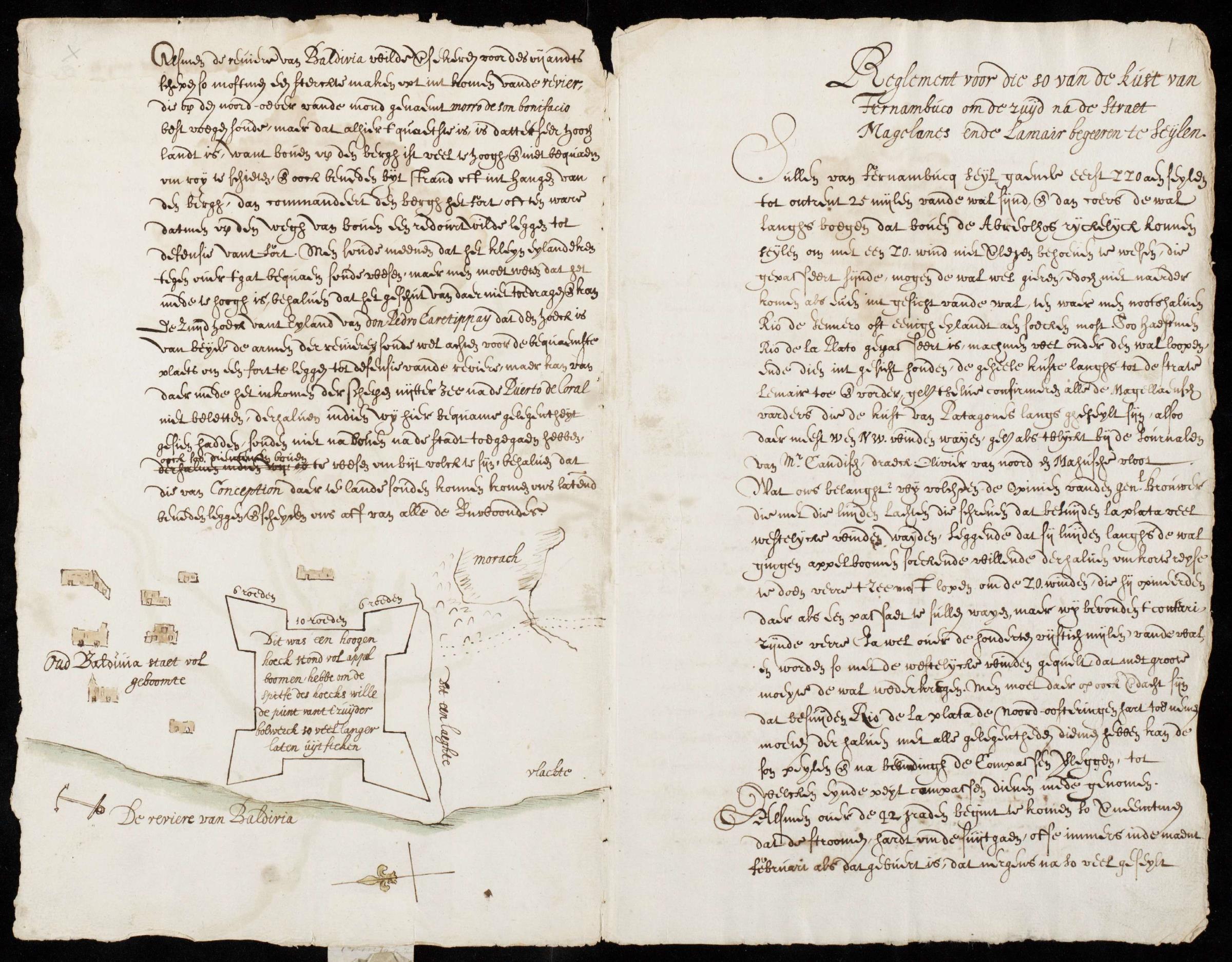
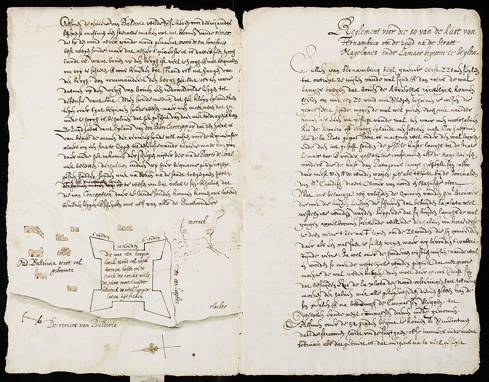
Nederlands: Kaart van het fort te Valdivia in Chili
English: Map of the fort at Valdivia in Chile( |
||||||||||||||||||||||||
|---|---|---|---|---|---|---|---|---|---|---|---|---|---|---|---|---|---|---|---|---|---|---|---|---|
| Author |
Nederlands: E. Herckmans (landmeter / kaartenmaker)
English: E. Herckmans (land surveyor / mapmaker) |
|||||||||||||||||||||||
| Title |
Nederlands: Kaart van het fort te Valdivia in Chili
English: Map of the fort at Valdivia in Chile |
|||||||||||||||||||||||
| Description |
Nederlands: Kaart van het fort te Valdivia in Chili.
Titel in Catalogus Leupe (NA): Plan van het Kasteel by Oud-Baldivia, aan de rivier gelegen. Volgens de plattegrond zijn er voor de bouw van het fort vele appelbomen gekapt. De kaarten VEL0737, VEL0738 en VEL0739 uit het Nationaal Archief komen allen uit hetzelfde reisjournaal van E. Herckmans uit 1643.English: Map of the fort at Valdivia in Chile.
Title in the Leupe Catalogue (NA): Plan van het Kasteel by Oud-Baldivia, aan de rivier gelegen. The map states that many apple trees had to be chopped down to build the fort. The maps VEL0737, VEL0738 and VEL0739 from the National Archives all derive from the same travel journal by E. Herckmans, dated 1643. |
|||||||||||||||||||||||
| Date | 1643 | |||||||||||||||||||||||
| Medium |
Nederlands: pen op papier
English: pen on paper |
|||||||||||||||||||||||
| Dimensions | height: 33 cm (12.9 in); width: 41.5 cm (16.3 in) | |||||||||||||||||||||||
| Collection |
|
|||||||||||||||||||||||
| Accession number |
NL-HaNA_4.VEL_738 (old number: VEL0738) |
|||||||||||||||||||||||
| Notes |
English: Subjects: chart / map / plan, fortification, building, compass / dial, house
Nederlands: Onderwerpen: plattegrond / kaart, vesting, gebouw, kompas / windroos, huis / woonhuis |
|||||||||||||||||||||||
| Source/Photographer |
|
|||||||||||||||||||||||
| Permission (Reusing this file) |
|
|||||||||||||||||||||||

| Object location | | View this and other nearby images on: OpenStreetMap |
|---|
File history
Click on a date/time to view the file as it appeared at that time.
| Date/Time | Thumbnail | Dimensions | User | Comment | |
|---|---|---|---|---|---|
| current | 10:23, 11 June 2014 | | 2,400 × 1,875 (645 KB) | HuskyBot (talk | contribs) | == {{int:filedesc}} == {{Artwork |title = {{nl|1=Kaart van het fort te Valdivia in Chili}} {{en|1=Map of the fort at Valdivia in Chile}} |description = {{nl|1=Kaart van het fort te Valdivia in Chili. Titel in... |
You cannot overwrite this file.
File usage on Commons
The following page uses this file: