File:AMH-8618-NA Map of North America and the Caribbean region.jpg
Size of this preview: 620 × 600 pixels. Other resolutions: 248 × 240 pixels | 496 × 480 pixels | 794 × 768 pixels | 1,058 × 1,024 pixels | 2,400 × 2,322 pixels.
Original file (2,400 × 2,322 pixels, file size: 978 KB, MIME type: image/jpeg)
Captions
Captions
Add a one-line explanation of what this file represents
Summary edit
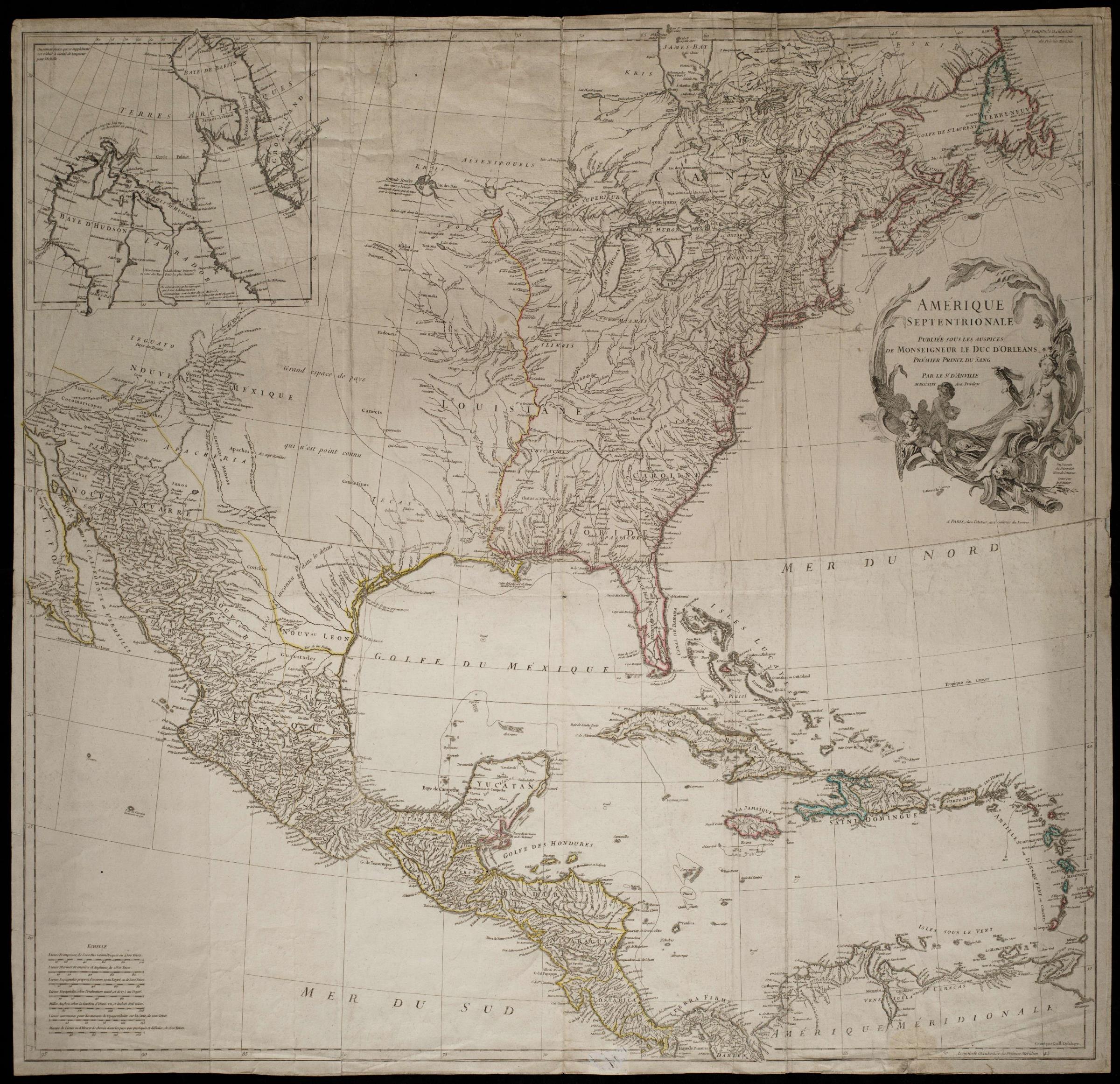
Nederlands: Kaart van Noord Amerika en het Caribisch gebied
English: Map of North America and the Caribbean region( |
||||||||||||||||||||||||
|---|---|---|---|---|---|---|---|---|---|---|---|---|---|---|---|---|---|---|---|---|---|---|---|---|
| Author |
Creator:D' Anville Creator:Guillaume de la Haye Nederlands: d' Anville (uitgever), Anoniem / Anonymous (landmeter / kaartenmaker), Guillaume de la Haye (graveur / etser)
English: d' Anville (publisher), Anoniem / Anonymous (land surveyor / mapmaker), Guillaume de la Haye (engraver / etcher) |
|||||||||||||||||||||||
| Title |
Nederlands: Kaart van Noord Amerika en het Caribisch gebied
English: Map of North America and the Caribbean region |
|||||||||||||||||||||||
| Description |
Nederlands: Kaart van Noord Amerika en het Caribisch gebied.
Titel Catalogus Leupe (NA): Amerique Septentrionale. Amerique Septentrionale.English: Map of North America and the Caribbean region.
Title in the Leupe Catalogue (NA): Amerique Septentrionale. Amerique Septentrionale. |
|||||||||||||||||||||||
| Date | 1746 | |||||||||||||||||||||||
| Medium |
Nederlands: koperdruk op papier
English: copperplate printing on paper |
|||||||||||||||||||||||
| Dimensions | height: 85.1 cm (33.5 in); width: 88.5 cm (34.8 in) | |||||||||||||||||||||||
| Collection |
|
|||||||||||||||||||||||
| Accession number |
NL-HaNA_4.VEL_1378 (old number: VEL1378) |
|||||||||||||||||||||||
| Inscriptions |
Amerique Septentrionale
author: Gravé par Guill: Delahaye / Publieé sous les Auspices / de Monseigneur le Duc d'Orleans / Prémier Prince du Sang / Par le St: D'Anville |
|||||||||||||||||||||||
| Notes |
English: Subjects: chart / map / plan, banderole / cartouche / ornamentation, Person, European, fauna
Nederlands: Onderwerpen: plattegrond / kaart, banderol / cartouche / versiering, Persoon, Europeanen, fauna
English: Post: this image is related to a WIC trading post called New York |
|||||||||||||||||||||||
| Source/Photographer |
|
|||||||||||||||||||||||
| Permission (Reusing this file) |
|
|||||||||||||||||||||||

| Object location | | View this and other nearby images on: OpenStreetMap |
|---|
File history
Click on a date/time to view the file as it appeared at that time.
| Date/Time | Thumbnail | Dimensions | User | Comment | |
|---|---|---|---|---|---|
| current | 10:28, 11 June 2014 | | 2,400 × 2,322 (978 KB) | HuskyBot (talk | contribs) | == {{int:filedesc}} == {{Artwork |title = {{nl|1=Kaart van Noord Amerika en het Caribisch gebied}} {{en|1=Map of North America and the Caribbean region}} |description = {{nl|1=Kaart van Noord Amerika en het Car... |
You cannot overwrite this file.
File usage on Commons
The following page uses this file: