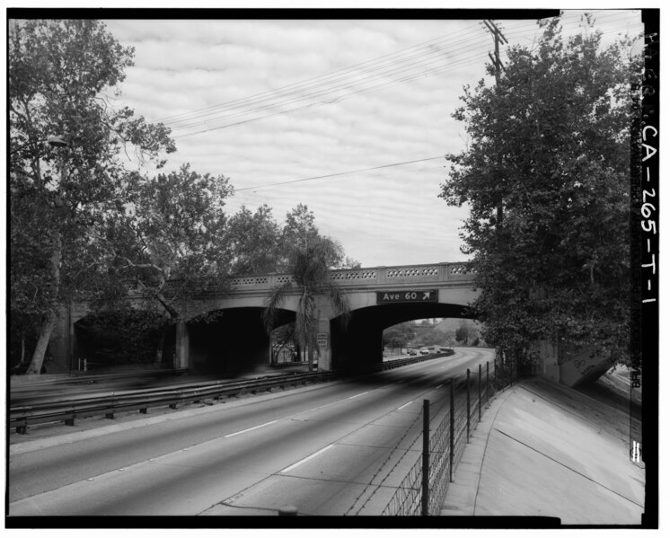
File:ARROYO SECO PARKWAY AND AVENUE 60 BRIDGE. NOTE CONCRETE EMBANKMENT OF ARROYO SECO CHANNEL ON RIGHT. LOOKING 12°N. - Arroyo Seco Parkway, Avenue 60 Bridge, Milepost 28.76 HAER CAL,19-LOSAN,83T-1.tif
Size of this JPG preview of this TIF file: 746 × 599 pixels. Other resolutions: 299 × 240 pixels | 598 × 480 pixels | 956 × 768 pixels | 1,275 × 1,024 pixels | 2,549 × 2,048 pixels | 5,063 × 4,068 pixels.
Original file (5,063 × 4,068 pixels, file size: 19.65 MB, MIME type: image/tiff)
Captions
Captions
Add a one-line explanation of what this file represents
Summary edit
| ARROYO SECO PARKWAY AND AVENUE 60 BRIDGE. NOTE CONCRETE EMBANKMENT OF ARROYO SECO CHANNEL ON RIGHT. LOOKING 12°N. - Arroyo Seco Parkway, Avenue 60 Bridge, Milepost 28.76, Los Angeles, Los Angeles County, CA | ||||
|---|---|---|---|---|
| Photographer |
Related names:
|
|||
| Title |
ARROYO SECO PARKWAY AND AVENUE 60 BRIDGE. NOTE CONCRETE EMBANKMENT OF ARROYO SECO CHANNEL ON RIGHT. LOOKING 12°N. - Arroyo Seco Parkway, Avenue 60 Bridge, Milepost 28.76, Los Angeles, Los Angeles County, CA |
|||
| Depicted place | California; Los Angeles County; Los Angeles | |||
| Date | Documentation compiled after 1968 | |||
| Dimensions | 4 x 5 in. | |||
| Current location |
Library of Congress Prints and Photographs Division Washington, D.C. 20540 USA http://hdl.loc.gov/loc.pnp/pp.print |
|||
| Accession number |
HAER CAL,19-LOSAN,83T-1 |
|||
| Credit line |
|
|||
| Notes |
|
|||
| Source | https://www.loc.gov/pictures/item/ca2774.photos.382791p | |||
| Permission (Reusing this file) |
|
|||

| Object location | | View this and other nearby images on: OpenStreetMap |
|---|
File history
Click on a date/time to view the file as it appeared at that time.
| Date/Time | Thumbnail | Dimensions | User | Comment | |
|---|---|---|---|---|---|
| current | 18:43, 7 July 2014 |  | 5,063 × 4,068 (19.65 MB) | Fæ (talk | contribs) | GWToolset: Creating mediafile for Fæ. HABS 05 July 2014 (401:500) |
You cannot overwrite this file.
File usage on Commons
The following 2 pages use this file:
- File:ARROYO SECO PARKWAY AND AVENUE 60 BRIDGE. NOTE CONCRETE EMBANKMENT OF ARROYO SECO CHANNEL ON RIGHT. LOOKING 12and-176;N. - Arroyo Seco Parkway, Avenue 60 Bridge, Milepost 28.76 HAER CAL,19-LOSAN,83T-1.tif (file redirect)
- File:ARROYO SECO PARKWAY AND AVENUE 60 BRIDGE. NOTE CONCRETE EMBANKMENT OF ARROYO SECO CHANNEL ON RIGHT. LOOKING 12°N. - Arroyo Seco Parkway, Avenue 60 Bridge, Milepost 28.76 HAER CAL,19-LOSAN,83T-1.tif