File:AVA Elmenteita Badlands.jpg

Size of this preview: 676 × 599 pixels. Other resolutions: 271 × 240 pixels | 541 × 480 pixels | 866 × 768 pixels | 1,200 × 1,064 pixels.
Original file (1,200 × 1,064 pixels, file size: 212 KB, MIME type: image/jpeg)
Captions
Captions
Add a one-line explanation of what this file represents
Summary edit
| Description |
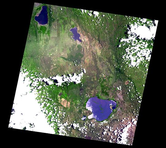
English: Area surrounding Elmenteita Badlands in Kenya. Includes Eburru, Ol Doin Yo. |
| Date | |
| Source | http://ava.jpl.nasa.gov/volcano.asp?vnum=0202-071 |
| Author | NASA ASTER Volcano Archive |
| Camera location | | View this and other nearby images on: OpenStreetMap |
|---|
Licensing edit
| This file is in the public domain in the United States because it was solely created by NASA. NASA copyright policy states that "NASA material is not protected by copyright unless noted". (See Template:PD-USGov, NASA copyright policy page or JPL Image Use Policy.) | ||
 |
Warnings:
|
File history
Click on a date/time to view the file as it appeared at that time.
| Date/Time | Thumbnail | Dimensions | User | Comment | |
|---|---|---|---|---|---|
| current | 21:34, 8 September 2008 | | 1,200 × 1,064 (212 KB) | Zro (talk | contribs) | {{Information |Description={{en|1=Area surrounding Elmenteita Badlands in Kenya. Includes Eburru, Ol Doin Yo.}} |Source=http://ava.jpl.nasa.gov/volcano.asp?vnum=0202-071 |Author=NASA ASTER Volcano Archive |Date=2007/09/11 |Permission= |other_versions= }} |
You cannot overwrite this file.
File usage on Commons
The following page uses this file:
File usage on other wikis
The following other wikis use this file:
- Usage on ca.wikipedia.org
- Usage on de.wikipedia.org
- Usage on en.wikipedia.org
- Usage on fa.wikipedia.org
- Usage on fr.wikipedia.org
- Usage on lld.wikipedia.org
- Usage on ru.wikipedia.org
- Usage on sk.wikipedia.org
- Usage on www.wikidata.org