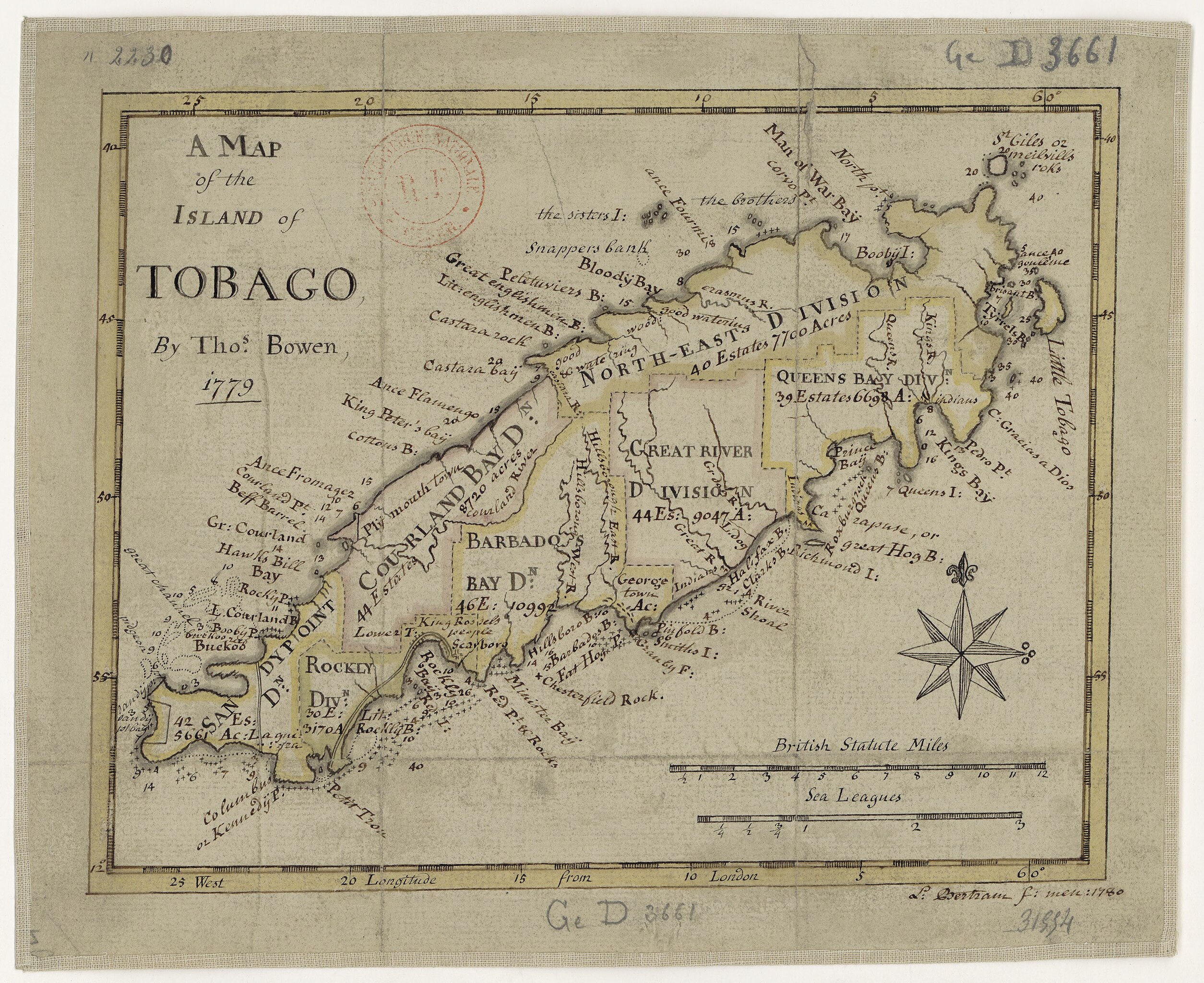
File:A Map of the island of Tabago - by Tho.s Bowen 1779 ; L. Bertram, f. 1780 - btv1b84424309.jpg

Size of this preview: 734 × 599 pixels. Other resolutions: 294 × 240 pixels | 588 × 480 pixels | 941 × 768 pixels | 1,254 × 1,024 pixels | 2,509 × 2,048 pixels | 4,488 × 3,664 pixels.
Original file (4,488 × 3,664 pixels, file size: 2.45 MB, MIME type: image/jpeg)
Captions
Captions
Add a one-line explanation of what this file represents
Summary
edit| A Map of the island of Tabago / by Tho.s Bowen 1779 ; L. Bertram, f. 1780
( |
|||||||||||||||||||||||||||
|---|---|---|---|---|---|---|---|---|---|---|---|---|---|---|---|---|---|---|---|---|---|---|---|---|---|---|---|
| Author |
Bowen, Thomas (173.-1790). Cartographe Bertram, L.. Auteur du texte |
||||||||||||||||||||||||||
| Title |
A Map of the island of Tabago / by Tho.s Bowen 1779 ; L. Bertram, f. 1780 |
||||||||||||||||||||||||||
| Description |
Français : Sujet : Tobago, Île de -- 1779
Couverture : Trinité-et-Tobago Langue : anglais Éditeur : [s.n.] |
||||||||||||||||||||||||||
| Date | 1780 | ||||||||||||||||||||||||||
| Dimensions | height: 19 cm (7.4 in); width: 24 cm (9.4 in) | ||||||||||||||||||||||||||
| Collection |
|
||||||||||||||||||||||||||
| References |
Français : Notice du catalogue : http://catalogue.bnf.fr/ark:/12148/cb40769035r |
||||||||||||||||||||||||||
| Source/Photographer |
Français : Bibliothèque nationale de France, GED-3661
Bibliothèque nationale de France |
||||||||||||||||||||||||||
| Permission (Reusing this file) |
|
||||||||||||||||||||||||||

File history
Click on a date/time to view the file as it appeared at that time.
| Date/Time | Thumbnail | Dimensions | User | Comment | |
|---|---|---|---|---|---|
| current | 04:51, 28 July 2022 | | 4,488 × 3,664 (2.45 MB) | Gzen92Bot (talk | contribs) | Gallica btv1b84424309 |
You cannot overwrite this file.
File usage on Commons
The following page uses this file: