File:A Pocket-Guide to the English Traveller... Cartes 21,22,23,24 de l'atlas - Thomas Gardner - btv1b530566327 (1 of 4).jpg

Original file (3,440 × 2,504 pixels, file size: 1.55 MB, MIME type: image/jpeg)
Captions
Captions
Summary edit
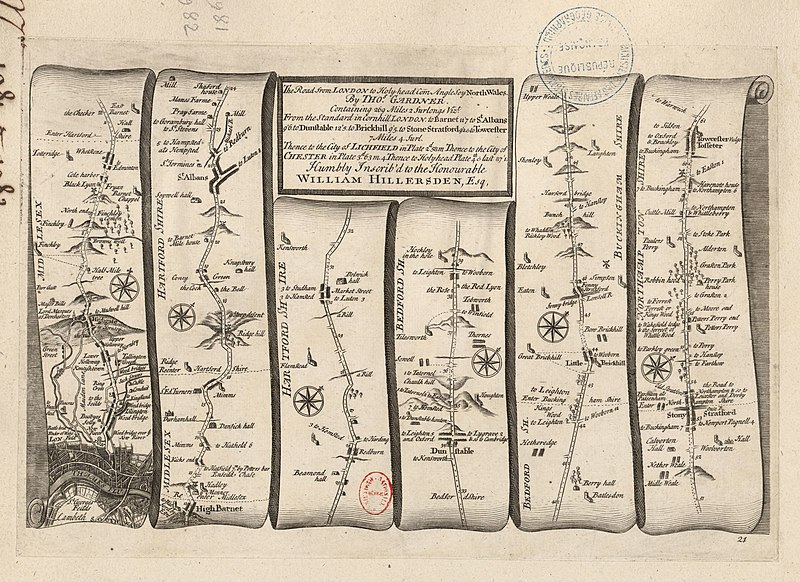
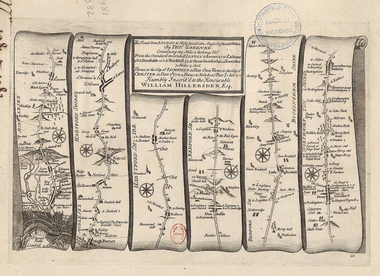
| A Pocket-Guide to the English Traveller... Cartes 21,22,23,24 de l'atlas / Thomas Gardner
( |
|||||||||||||||||||||||||||
|---|---|---|---|---|---|---|---|---|---|---|---|---|---|---|---|---|---|---|---|---|---|---|---|---|---|---|---|
| Author |
Gardner, Thomas (16..-17..). Cartographe |
||||||||||||||||||||||||||
| Title |
A Pocket-Guide to the English Traveller... Cartes 21,22,23,24 de l'atlas / Thomas Gardner |
||||||||||||||||||||||||||
| Description |
Français : Sujet : Bedford, Comté de
Buckingham, Comté de Chester, Comté de Hertford, Comté de Middlesex, Comté du Northampton, Comté de Stafford, Comté de Warwick, Comté de Anglesey, Comté d' Caernarvon, Comté de Denbigh, Comté de Flint, Comté de Échelle(s) : [Sans échelle] Comprend : The Road from London to Holy-head ; The Continuation of the Road from London to Holy head ; The Continuation of ye Road from London to Holy-head ; The Continuation of the Road from London to Holy Head Appartient à l’ensemble documentaire : AnvilEur Appartient à l’ensemble documentaire : MAEDI008 Appartient à l’ensemble documentaire : MAEDIGen0 Couverture : Royaume-Uni – Angleterre Royaume-Uni – Pays de Galles Langue : anglais Éditeur : [Printed for J. Tonson... and J. Watts...] (London) |
||||||||||||||||||||||||||
| Date | 1719 | ||||||||||||||||||||||||||
| Dimensions | height: 28 cm (11 in); width: 18 cm (7 in) | ||||||||||||||||||||||||||
| Collection |
|
||||||||||||||||||||||||||
| References |
Français : Notice d'ensemble : http://catalogue.bnf.fr/ark:/12148/cb411851614
Notice de recueil : http://catalogue.bnf.fr/ark:/12148/cb40577015h Appartient à : Collection d'Anville ; 01981-01982 Notice du catalogue : http://catalogue.bnf.fr/ark:/12148/cb411851614 Extrait de A Pocket-Guide to the English Traveller... Printed for J. Tonson... and J. Watts... MDCCXIX [1719], . |
||||||||||||||||||||||||||
| Source/Photographer |
Français : Bibliothèque nationale de France, département Cartes et plans, GE DD-2987 (1981-1982)
Bibliothèque nationale de France (1/4) |
||||||||||||||||||||||||||
| Permission (Reusing this file) |
|
||||||||||||||||||||||||||

.jpg&action=edit§ion=1)
File history
Click on a date/time to view the file as it appeared at that time.
| Date/Time | Thumbnail | Dimensions | User | Comment | |
|---|---|---|---|---|---|
| current | 02:34, 15 August 2022 | | 3,440 × 2,504 (1.55 MB) | Gzen92Bot (talk | contribs) | Gallica btv1b530566327 |
You cannot overwrite this file.
File usage on Commons
The following page uses this file:
.jpg)
.jpg&oldid=825566813)