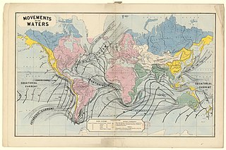
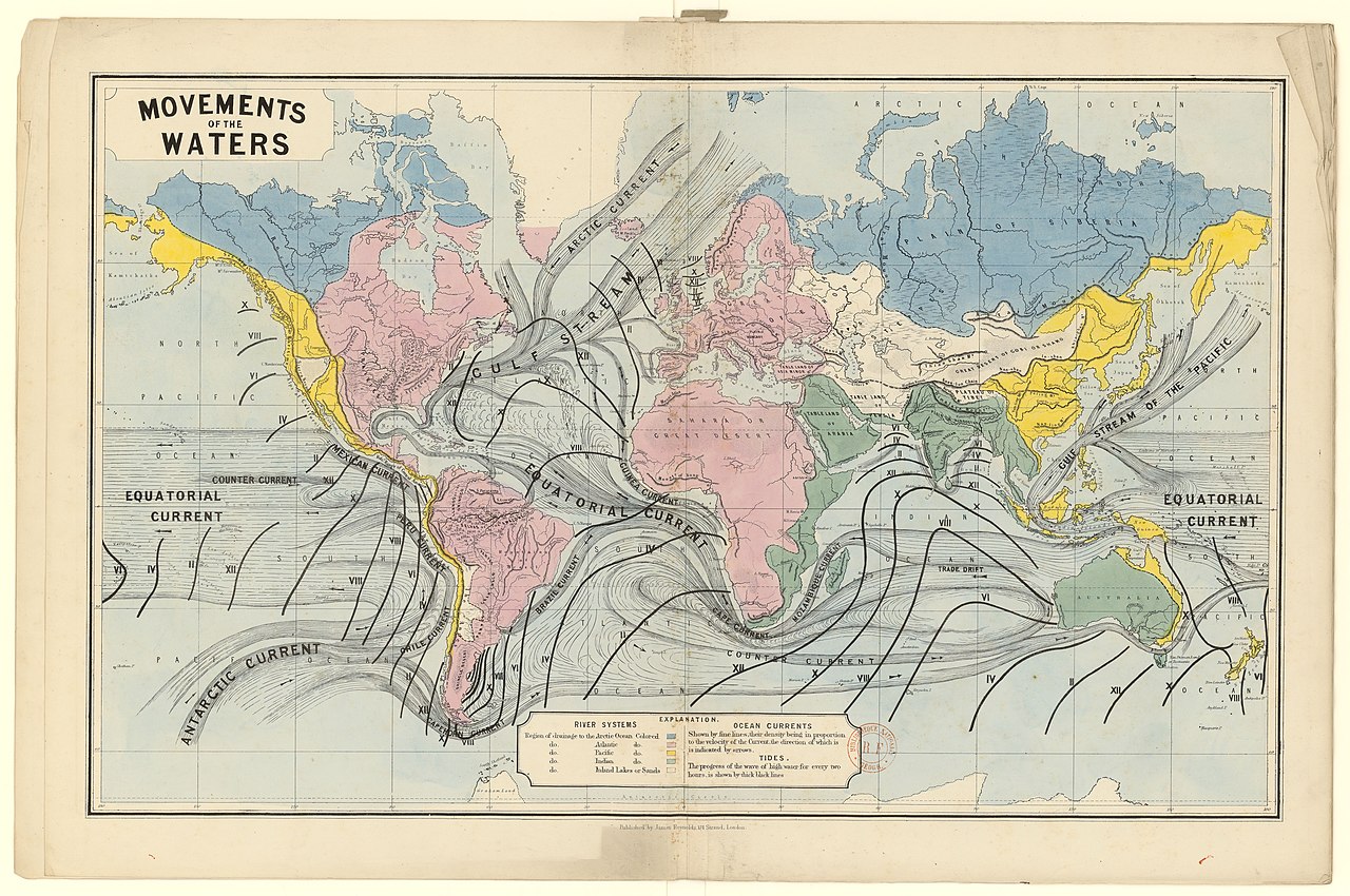
File:A Series of large coloured diagrams illustrative of physical geography... - btv1b53029124x (3 of 7).jpg

Size of this preview: 800 × 531 pixels. Other resolutions: 320 × 213 pixels | 640 × 425 pixels | 1,024 × 680 pixels | 1,280 × 850 pixels | 2,560 × 1,700 pixels | 9,442 × 6,271 pixels.
Original file (9,442 × 6,271 pixels, file size: 8.54 MB, MIME type: image/jpeg)
Captions
Captions
Add a one-line explanation of what this file represents
Summary
edit| Warning | The original file is very high-resolution. It might not load properly or could cause your browser to freeze when opened at full size. |
|---|
| A Series of large coloured diagrams illustrative of physical geography...
( |
|||||||||||||||||||||||||||
|---|---|---|---|---|---|---|---|---|---|---|---|---|---|---|---|---|---|---|---|---|---|---|---|---|---|---|---|
| Title |
A Series of large coloured diagrams illustrative of physical geography... |
||||||||||||||||||||||||||
| Description |
Français : Sujet : Statistique
Géographie physique Langue : anglais Éditeur : J. Reynolds (London) |
||||||||||||||||||||||||||
| Date | 1880s | ||||||||||||||||||||||||||
| Collection |
|
||||||||||||||||||||||||||
| References |
Français : Notice du catalogue : http://catalogue.bnf.fr/ark:/12148/cb40673838k |
||||||||||||||||||||||||||
| Source/Photographer |
Français : Bibliothèque nationale de France, département Cartes et plans, GE C-2086
Bibliothèque nationale de France (3/7) |
||||||||||||||||||||||||||
| Permission (Reusing this file) |
|
||||||||||||||||||||||||||

.jpg&action=edit§ion=1)
.jpg&flash=no)
File history
Click on a date/time to view the file as it appeared at that time.
| Date/Time | Thumbnail | Dimensions | User | Comment | |
|---|---|---|---|---|---|
| current | 18:04, 12 July 2022 | | 9,442 × 6,271 (8.54 MB) | Gzen92Bot (talk | contribs) | Gallica btv1b53029124x |
You cannot overwrite this file.
File usage on Commons
The following page uses this file:
.jpg)
.jpg&oldid=825567303)