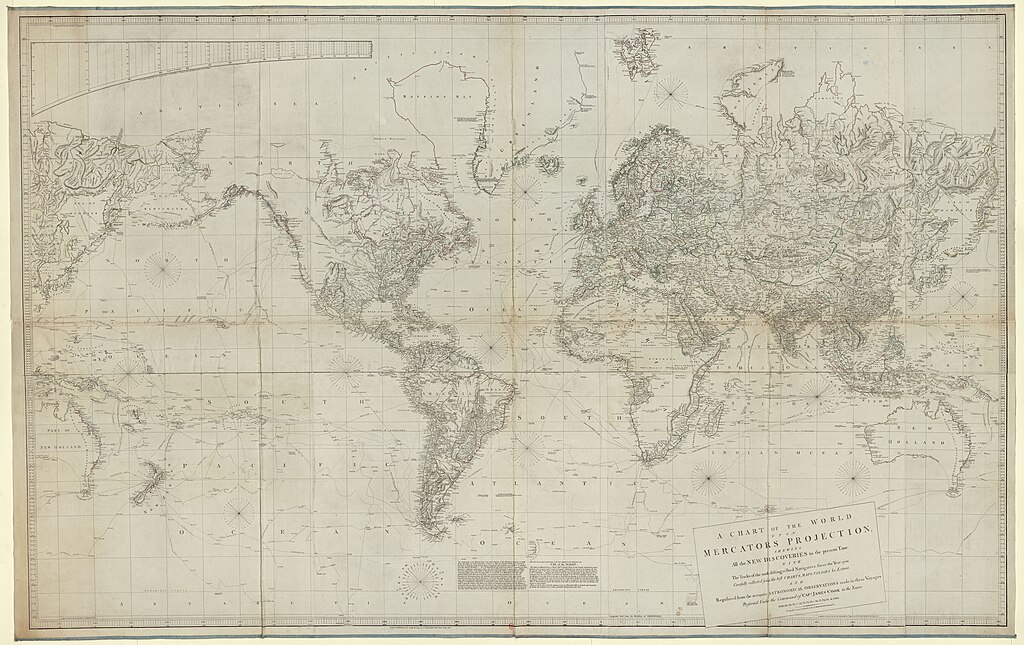
File:A chart of the world upon Mercators projection shewing all the new discoveries to the present time - with the tracks of the most distinguished navigators since the year 1700 carefully collected from the best charts... - btv1b5970607j.jpg

Size of this preview: 800 × 504 pixels. Other resolutions: 320 × 202 pixels | 640 × 403 pixels | 1,024 × 645 pixels | 1,280 × 806 pixels | 2,560 × 1,612 pixels | 24,966 × 15,724 pixels.
Original file (24,966 × 15,724 pixels, file size: 48.47 MB, MIME type: image/jpeg)
Captions
Captions
Add a one-line explanation of what this file represents
Summary
edit| Warning | The original file is very high-resolution. It might not load properly or could cause your browser to freeze when opened at full size. |
|---|
| Author |
Arrowsmith, Aaron (1750-1833). Cartographe |
||||||||||||||||||||||||||
| Title |
A chart of the world upon Mercators projection shewing all the new discoveries to the present time : with the tracks of the most distinguished navigators since the year 1700 carefully collected from the best charts, maps, voyages etc. Extant and regulated from the accurate Astronomical observations... / by A. Arrowsmith, geographer |
||||||||||||||||||||||||||
| Description |
Français : Sujet : Cook, James (1728-1779)
Explorateurs Voyages en mer Îles Monde -- Côtes Pacifique, Océan Échelle(s) : [1:22 250 000 environ à l'Equateur] Couverture : Monde Mers W 180° - E 180° / N 90° - S 90° Langue : anglais Éditeur : A. Arrowsmith (London) |
||||||||||||||||||||||||||
| Date | 1790 | ||||||||||||||||||||||||||
| Dimensions | height: 208 cm (81.8 in); width: 131 cm (51.5 in) | ||||||||||||||||||||||||||
| Collection |
|
||||||||||||||||||||||||||
| References |
Français : Notice de recueil : http://catalogue.bnf.fr/ark:/12148/cb421491424
Appartient à : [Portefeuille 1 du Service hydrographique de la marine consacré aux mappemondes, cartes magnétiques, cartes polaires et planisphères avant 1800] ; 29 Notice du catalogue : http://catalogue.bnf.fr/ark:/12148/cb405922487 |
||||||||||||||||||||||||||
| Source/Photographer |
Français : Bibliothèque nationale de France, département Cartes et plans, GE SH 18 PF 1 DIV 0 P 29
Bibliothèque nationale de France |
||||||||||||||||||||||||||
| Permission (Reusing this file) |
|
||||||||||||||||||||||||||

File history
Click on a date/time to view the file as it appeared at that time.
| Date/Time | Thumbnail | Dimensions | User | Comment | |
|---|---|---|---|---|---|
| current | 10:42, 1 July 2022 | | 24,966 × 15,724 (48.47 MB) | Gzen92Bot (talk | contribs) | Gallica btv1b5970607j |
You cannot overwrite this file.
File usage on Commons
The following page uses this file: