File:A walk through Harrison's Plantation (8) - geograph.org.uk - 727333.jpg
No higher resolution available.
A_walk_through_Harrison's_Plantation_(8)_-_geograph.org.uk_-_727333.jpg (640 × 427 pixels, file size: 132 KB, MIME type: image/jpeg)
Captions
Captions
Add a one-line explanation of what this file represents
Summary
edit_-_geograph.org.uk_-_727333.jpg&action=edit§ion=1)
| Description |
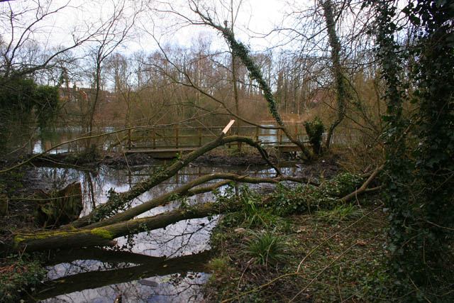
English: A walk through Harrison's Plantation (8). The footpath through Harrison's Plantation circumnavigates Raleigh Pond along the top of the bank round this old claypit. This view shows the foot bridge which carries the lower waterside path across the marshy outflow to the south east. See http://www.wildlifetrust.org.uk/nottinghamshire/reserves/Harrison's%20Plantation.htm
Finish the walk by following the footpath east to the gate on Lambourne Drive. Previous image 727318 |
| Date | |
| Source | From geograph.org.uk |
| Author | Kate Jewell |
| Attribution (required by the license) | Kate Jewell / A walk through Harrison's Plantation (8) / |
_-_geograph.org.uk_-_727318.jpg)
| Camera location | | View this and other nearby images on: OpenStreetMap |
|---|
_-_geograph.org.uk_-_727333.jpg¶ms=052.957130_N_-001.210500_E_globe:Earth_type:camera_source:geograph-osgb36(SK53134026)_heading:0.00&language=en)
| Object location | | View this and other nearby images on: OpenStreetMap |
|---|
_-_geograph.org.uk_-_727333.jpg¶ms=052.957400_N_-001.210500_E_globe:Earth_class:object_type:object_source:geograph-osgb36(SK53134029)_heading:0.00&language=en)
Licensing
edit_-_geograph.org.uk_-_727333.jpg&action=edit§ion=2)

|
This image was taken from the Geograph project collection. See this photograph's page on the Geograph website for the photographer's contact details. The copyright on this image is owned by Kate Jewell and is licensed for reuse under the Creative Commons Attribution-ShareAlike 2.0 license.
|
This file is licensed under the Creative Commons Attribution-Share Alike 2.0 Generic license.
Attribution: Kate Jewell
- You are free:
- to share – to copy, distribute and transmit the work
- to remix – to adapt the work
- Under the following conditions:
- attribution – You must give appropriate credit, provide a link to the license, and indicate if changes were made. You may do so in any reasonable manner, but not in any way that suggests the licensor endorses you or your use.
- share alike – If you remix, transform, or build upon the material, you must distribute your contributions under the same or compatible license as the original.
File history
Click on a date/time to view the file as it appeared at that time.
| Date/Time | Thumbnail | Dimensions | User | Comment | |
|---|---|---|---|---|---|
| current | 03:56, 19 February 2011 | | 640 × 427 (132 KB) | GeographBot (talk | contribs) | == {{int:filedesc}} == {{Information |description={{en|1=A walk through Harrison's Plantation (8) The footpath through Harrison's Plantation circumnavigates Raleigh Pond along the top of the bank round this old claypit. This view shows the foot bridge whi |
You cannot overwrite this file.
File usage on Commons
There are no pages that use this file.
_-_geograph.org.uk_-_727333.jpg&oldid=779110881)