File:Administrative Map of Adygea.svg

Size of this PNG preview of this SVG file: 631 × 600 pixels. Other resolutions: 252 × 240 pixels | 505 × 480 pixels | 808 × 768 pixels | 1,077 × 1,024 pixels | 2,154 × 2,048 pixels | 691 × 657 pixels.
Original file (SVG file, nominally 691 × 657 pixels, file size: 232 KB)
Captions
Captions
Add a one-line explanation of what this file represents
Summary edit
| Description |
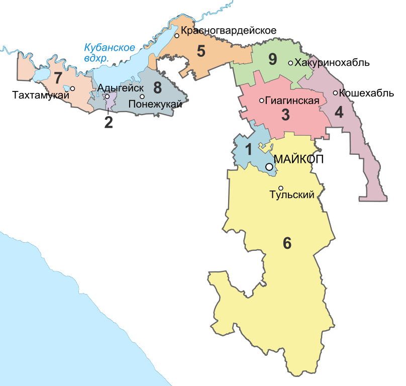
Русский: Административно-территриальное деление Адыгеи. |
| Date | |
| Source |
This W3C-unspecified vector image was created with Inkscape . |
| Author | Nzeemin |
Licensing edit
This file is licensed under the Creative Commons Attribution-Share Alike 2.0 Generic license.
- You are free:
- to share – to copy, distribute and transmit the work
- to remix – to adapt the work
- Under the following conditions:
- attribution – You must give appropriate credit, provide a link to the license, and indicate if changes were made. You may do so in any reasonable manner, but not in any way that suggests the licensor endorses you or your use.
- share alike – If you remix, transform, or build upon the material, you must distribute your contributions under the same or compatible license as the original.
File history
Click on a date/time to view the file as it appeared at that time.
| Date/Time | Thumbnail | Dimensions | User | Comment | |
|---|---|---|---|---|---|
| current | 14:12, 1 April 2012 | | 691 × 657 (232 KB) | Nzeemin (talk | contribs) | crop |
| 13:58, 1 April 2012 |  | 734 × 715 (231 KB) | Nzeemin (talk | contribs) | fixed black rect | |
| 13:48, 1 April 2012 |  | 734 × 715 (232 KB) | Nzeemin (talk | contribs) | background | |
| 13:45, 1 April 2012 |  | 734 × 715 (229 KB) | Nzeemin (talk | contribs) |
You cannot overwrite this file.
File usage on Commons
The following page uses this file:
File usage on other wikis
The following other wikis use this file:
- Usage on ast.wikipedia.org
- Usage on azb.wikipedia.org
- Usage on ce.wikipedia.org
- Usage on cv.wikipedia.org
- Usage on es.wikipedia.org
- Usage on fy.wikipedia.org
- Usage on gl.wikipedia.org
- Usage on kbd.wikipedia.org
- Usage on kv.wikipedia.org
- Usage on ru.wikipedia.org
- Usage on sk.wikipedia.org
- Usage on sr.wikipedia.org