File:Administrative map of Vietnam from Aug2008.png

Size of this preview: 306 × 599 pixels. Other resolutions: 122 × 240 pixels | 245 × 480 pixels | 392 × 768 pixels | 1,200 × 2,349 pixels.
Original file (1,200 × 2,349 pixels, file size: 546 KB, MIME type: image/png)
Captions
Captions
Add a one-line explanation of what this file represents
Summary
edit
| Description |
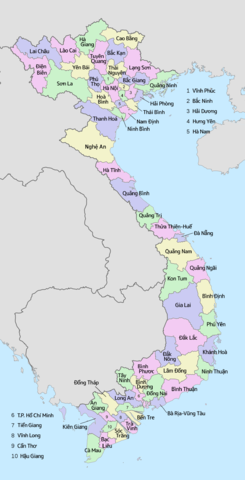
English: Administrative map of Vietnam from Aug2008. if you find something wrong, please send message to me. 日本語: ベトナムの行政地図(2008年8月以降)。不具合があればご連絡ください。 Tiếng Việt: Bản đồ hánh chình Việt Nam (từ tháng 8 năm 2008). Nếu có điều gì sai thì hãy gửi thông điệp ạ. |
| Date | |
| Source | Own work |
| Author | Tonbi ko |
Licensing
edit
I, the copyright holder of this work, hereby publish it under the following license:
This file is licensed under the Creative Commons Attribution-Share Alike 4.0 International license.
- You are free:
- to share – to copy, distribute and transmit the work
- to remix – to adapt the work
- Under the following conditions:
- attribution – You must give appropriate credit, provide a link to the license, and indicate if changes were made. You may do so in any reasonable manner, but not in any way that suggests the licensor endorses you or your use.
- share alike – If you remix, transform, or build upon the material, you must distribute your contributions under the same or compatible license as the original.
File history
Click on a date/time to view the file as it appeared at that time.
| Date/Time | Thumbnail | Dimensions | User | Comment | |
|---|---|---|---|---|---|
| current | 08:17, 10 December 2016 | | 1,200 × 2,349 (546 KB) | Tonbi ko (talk | contribs) | correct province name (Tiềng Giang -> Tiền Giang) |
| 05:51, 25 February 2016 |  | 1,200 × 2,349 (546 KB) | Tonbi ko (talk | contribs) | correct: Cần Giờ district was not included to HCMC. and due to it, some color change. | |
| 07:52, 29 August 2015 |  | 1,200 × 2,349 (546 KB) | Tonbi ko (talk | contribs) | Decrease colors (5 to 4), paint some islands (Đảo Bạch Long Vĩ Hải Phòng, Hòn Mê Thành Hoá, Đảo Lỳ Sơn Quảng Ngãi, Cù lao Thu Bình Thuận, Cù lao lớn ở Hậu giang Soc Trăng....) | |
| 09:52, 28 August 2015 |  | 1,200 × 2,349 (548 KB) | Tonbi ko (talk | contribs) | User created page with UploadWizard |
You cannot overwrite this file.
File usage on Commons
There are no pages that use this file.
File usage on other wikis
The following other wikis use this file:
- Usage on fr.wikipedia.org
- Usage on ja.wikipedia.org