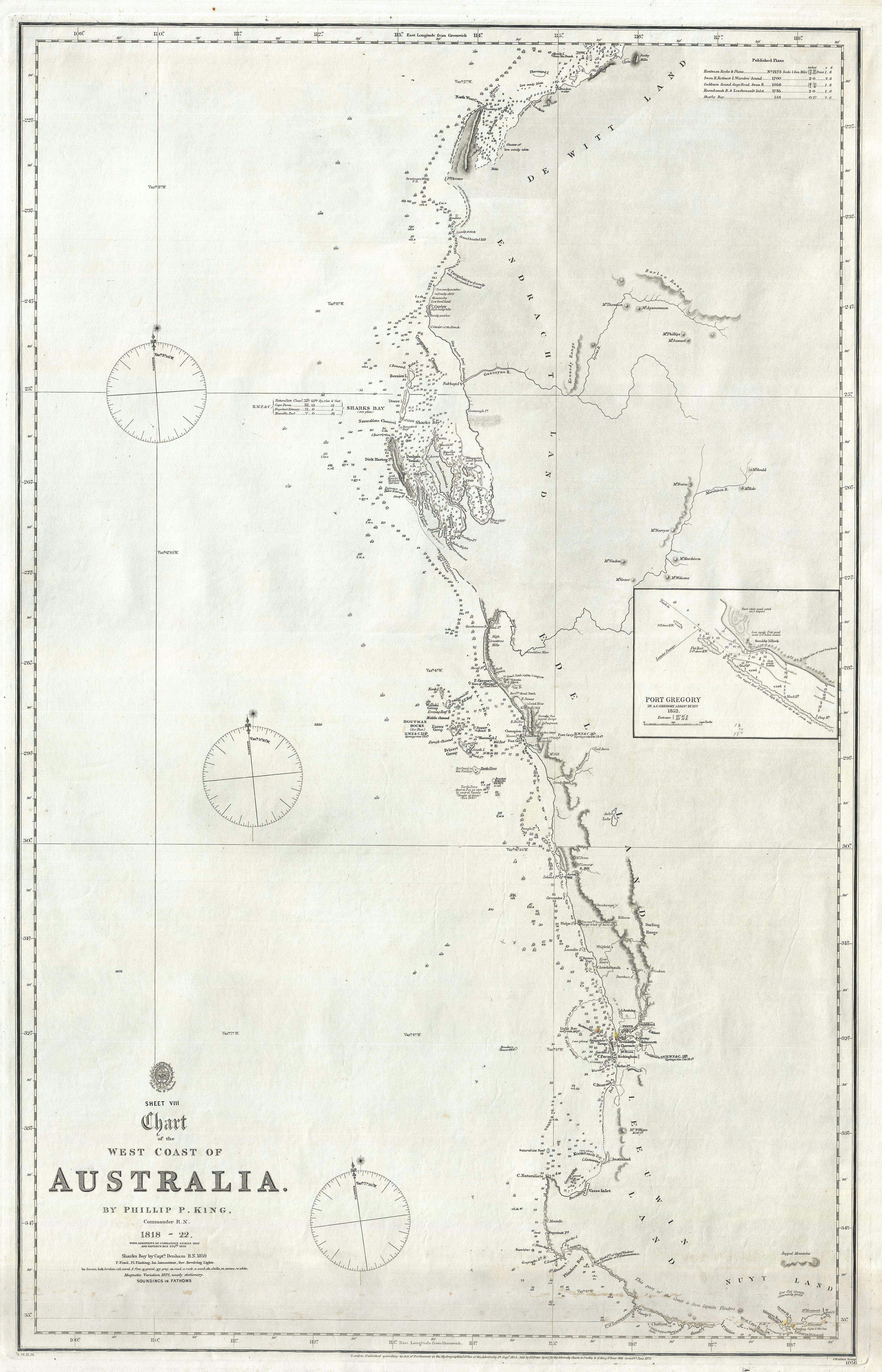
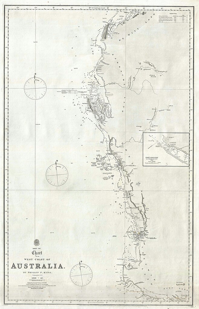
File:Admiralty Chart No 1056 Sheet VIII Chart of the West Coast of Australia, Published 1825, Corrections to 1875.jpg
Size of this preview: 385 × 599 pixels. Other resolutions: 154 × 240 pixels | 309 × 480 pixels | 494 × 768 pixels | 658 × 1,024 pixels | 1,317 × 2,048 pixels | 3,859 × 6,000 pixels.
Original file (3,859 × 6,000 pixels, file size: 4.09 MB, MIME type: image/jpeg)
Captions
Captions
1872 Admiralty Map - Sheet VIII Chart of the West Coast of Australia.
Summary edit
| Description |
English: 1872 Admiralty Map - Sheet VIII Chart of the West Coast of Australia. |
||||||||||
| Date | |||||||||||
| Source | https://www.geographicus.com/P/AntiqueMap/WesternAustralia-king-1872 | ||||||||||
| Author |
|
||||||||||
Licensing edit
|
This work is in the public domain in its country of origin and other countries and areas where the copyright term is the author's life plus 70 years or fewer. This work is in the public domain in the United States because it was published (or registered with the U.S. Copyright Office) before January 1, 1929. | |
| This file has been identified as being free of known restrictions under copyright law, including all related and neighboring rights. | |
File history
Click on a date/time to view the file as it appeared at that time.
| Date/Time | Thumbnail | Dimensions | User | Comment | |
|---|---|---|---|---|---|
| current | 12:16, 14 March 2020 | | 3,859 × 6,000 (4.09 MB) | Balkanique (talk | contribs) | Uploaded a work by British Admiralty from https://www.geographicus.com/P/AntiqueMap/WesternAustralia-king-1872 with UploadWizard |
You cannot overwrite this file.
File usage on Commons
The following page uses this file: