File:Admiralty Chart No 1056 West Coast of Australia. Sheet VIII, Published 1835.jpg

Size of this preview: 458 × 600 pixels. Other resolutions: 183 × 240 pixels | 366 × 480 pixels | 586 × 768 pixels | 782 × 1,024 pixels | 1,564 × 2,048 pixels | 7,520 × 9,848 pixels.
Original file (7,520 × 9,848 pixels, file size: 53.58 MB, MIME type: image/jpeg)
Captions
Captions
Nautical chart of the West Coast of Australia Sheet VII
Summary edit
| Description |
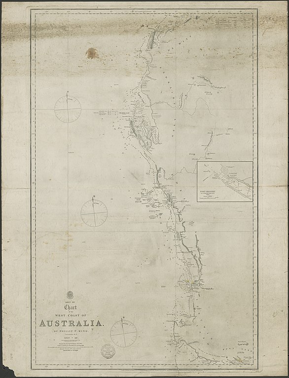
English: Nautical chart of the West Coast of Australia Sheet VIII. Surveyed by Phillip P. King, Commander R.N. 1818-22, with additions by Commander Stokes 1842 and Septimus Roe esqre 1855. Sharks Bay by Captn. Denham R.N. 1859. Not current - not to be used for navigation! |
||||||||||
| Date | |||||||||||
| Source | https://nla.gov.au/nla.obj-230055526 | ||||||||||
| Author |
|
||||||||||
Licensing edit
This work created by the United Kingdom Government is in the public domain.
This is because it is one of the following:
HMSO has declared that the expiry of Crown Copyrights applies worldwide (ref: HMSO Email Reply)
|
 |
File history
Click on a date/time to view the file as it appeared at that time.
| Date/Time | Thumbnail | Dimensions | User | Comment | |
|---|---|---|---|---|---|
| current | 22:06, 16 March 2020 | | 7,520 × 9,848 (53.58 MB) | Kognos (talk | contribs) | Uploaded a work by Hydrographical Office of the Admiralty from https://nla.gov.au/nla.obj-230055526 with UploadWizard |
You cannot overwrite this file.
File usage on Commons
There are no pages that use this file.