File:Admiralty Chart No 1709 Charlottetown Harbour, Published 1845.jpg

Size of this preview: 789 × 600 pixels. Other resolutions: 316 × 240 pixels | 632 × 480 pixels | 1,011 × 768 pixels | 1,280 × 973 pixels | 2,560 × 1,946 pixels | 7,971 × 6,058 pixels.
Original file (7,971 × 6,058 pixels, file size: 8.84 MB, MIME type: image/jpeg)
Captions
Captions
Nautical chart of Charlottetown Harbour, Prince Edward Island, Canada
Summary
edit
| Description |
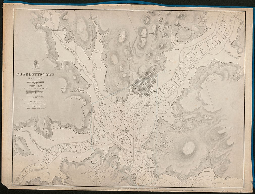
English: Nautical chart of Charlottetown Harbour, Prince Edward Island, Canada. Surveyed by Captain H.W. Bayfield assisted by Lieuts. J. Orlebar & G.A. Bedford, 1843. Not current - not to be used for navigation! |
||||||||||
| Date | |||||||||||
| Source | https://archive.org/details/McGillLibrary-rbsc_map_bayfield-072-19176 | ||||||||||
| Creator |
|
||||||||||
| Geotemporal data | |||||||||||
| Bounding box |
|
||||||||||
| Georeferencing | |||||||||||
Licensing
edit
This work created by the United Kingdom Government is in the public domain.
This is because it is one of the following:
HMSO has declared that the expiry of Crown Copyrights applies worldwide (ref: HMSO Email Reply)
|
 |
File history
Click on a date/time to view the file as it appeared at that time.
| Date/Time | Thumbnail | Dimensions | User | Comment | |
|---|---|---|---|---|---|
| current | 11:42, 7 September 2019 | | 7,971 × 6,058 (8.84 MB) | Kognos (talk | contribs) | User created page with UploadWizard |
You cannot overwrite this file.
File usage on Commons
There are no pages that use this file.