File:Admiralty Chart No 1808 Africa east coast Cape Delgado to Kilwa, Published1875.jpg

Size of this preview: 453 × 600 pixels. Other resolutions: 181 × 240 pixels | 362 × 480 pixels | 580 × 768 pixels | 773 × 1,024 pixels | 1,547 × 2,048 pixels | 6,208 × 8,220 pixels.
Original file (6,208 × 8,220 pixels, file size: 5.59 MB, MIME type: image/jpeg)
Captions
Captions
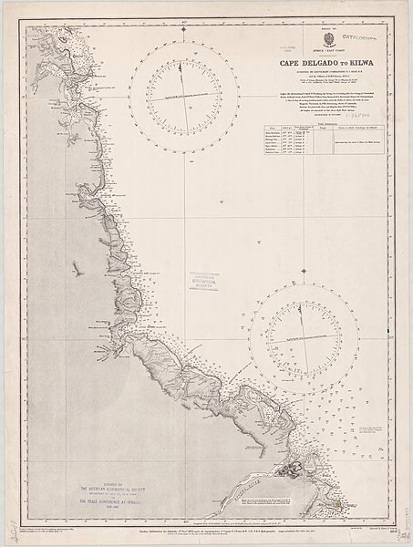
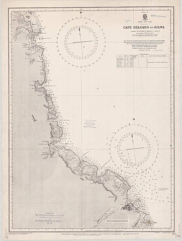
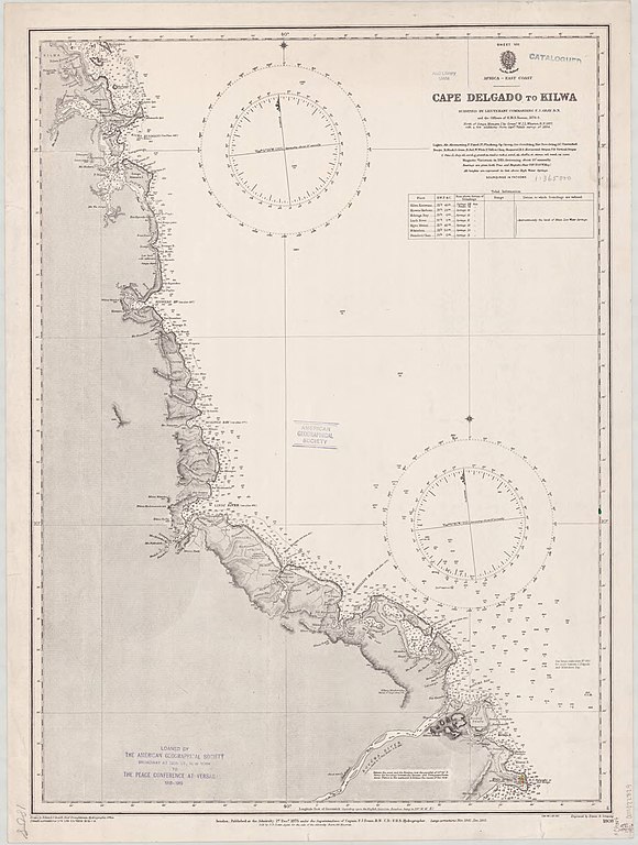
Nautical chart of the east coast of Africa from Cape Delgado to Kilwa
Summary
edit
| Description |
English: Nautical chart of the east coast of Africa from Cape Delgado to Kilwa. Surveyed by Lieutenant Commanding F.J. Gray and the officers of H.M.S. Nassau, 1874-5. Not current - not to be used for navigation! |
||||||||||
| Date | |||||||||||
| Source | https://collections.lib.uwm.edu/digital/collection/agdm/id/9070/rec/181 | ||||||||||
| Author |
|
||||||||||
Licensing
edit
This work created by the United Kingdom Government is in the public domain.
This is because it is one of the following:
HMSO has declared that the expiry of Crown Copyrights applies worldwide (ref: HMSO Email Reply)
|
 |
File history
Click on a date/time to view the file as it appeared at that time.
| Date/Time | Thumbnail | Dimensions | User | Comment | |
|---|---|---|---|---|---|
| current | 22:35, 20 November 2019 | | 6,208 × 8,220 (5.59 MB) | Kognos (talk | contribs) | User created page with UploadWizard |
You cannot overwrite this file.
File usage on Commons
The following page uses this file:
File usage on other wikis
The following other wikis use this file:
- Usage on en.wikipedia.org