File:Admiralty Chart No 2407 Scotland - west coast - Little Loch Broom, Published 1910.jpg

Size of this preview: 800 × 529 pixels. Other resolutions: 320 × 212 pixels | 640 × 423 pixels | 1,024 × 678 pixels | 1,280 × 847 pixels | 2,560 × 1,694 pixels | 10,070 × 6,663 pixels.
Original file (10,070 × 6,663 pixels, file size: 34.38 MB, MIME type: image/jpeg)
Captions
Captions
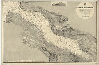
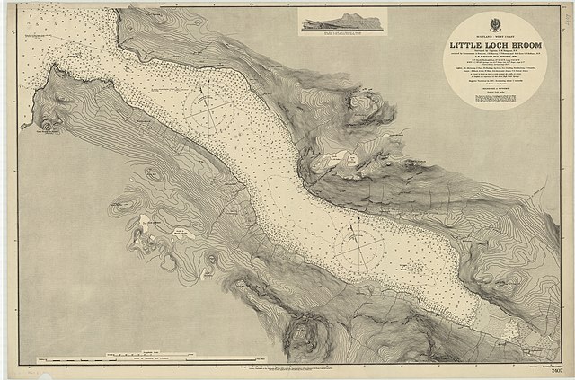
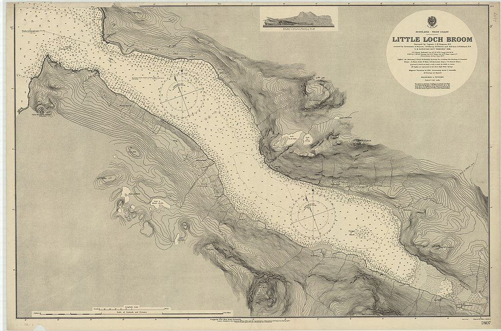
Nautical chart of Little Loch Broom
Summary
edit
| Description |
English: Nautical chart of Little Loch Broom. Surveyed by Captain C.H. Simpson assisteb by Lieutenants A. Truscott, J.R. Harvey, H.T. Bowen and Sub-Lieut. L.E. Holland, H.M. Surveying Ship Research 1908. Not current - not to be used for navigation! |
||||||||||
| Date | |||||||||||
| Source | https://maps.nls.uk/view/101955401 | ||||||||||
| Creator |
|
||||||||||
| Geotemporal data | |||||||||||
| Scale | 1:14,690 | ||||||||||
| Georeferencing | |||||||||||
Licensing
edit
Original chart:
This work created by the United Kingdom Government is in the public domain.
This is because it is one of the following:
HMSO has declared that the expiry of Crown Copyrights applies worldwide (ref: HMSO Email Reply)
|
 |
Any derivative rights in the digital version have been released by the National Library of Scotland under the following license:
This file is licensed under the Creative Commons Attribution 4.0 International license.
- You are free:
- to share – to copy, distribute and transmit the work
- to remix – to adapt the work
- Under the following conditions:
- attribution – You must give appropriate credit, provide a link to the license, and indicate if changes were made. You may do so in any reasonable manner, but not in any way that suggests the licensor endorses you or your use.
File history
Click on a date/time to view the file as it appeared at that time.
| Date/Time | Thumbnail | Dimensions | User | Comment | |
|---|---|---|---|---|---|
| current | 09:20, 26 September 2021 | | 10,070 × 6,663 (34.38 MB) | Kognos (talk | contribs) | Uploaded a work by H.E. Purey-Cust from https://maps.nls.uk/view/101955401 with UploadWizard |
You cannot overwrite this file.
File usage on Commons
There are no pages that use this file.
File usage on other wikis
The following other wikis use this file:
- Usage on de.wikipedia.org