File:Admiralty Chart No 2452 Virgin Islands Sheet III, Published 1856.jpg

Size of this preview: 800 × 529 pixels. Other resolutions: 320 × 211 pixels | 640 × 423 pixels | 1,024 × 677 pixels | 1,280 × 846 pixels | 2,560 × 1,692 pixels | 23,952 × 15,829 pixels.
Original file (23,952 × 15,829 pixels, file size: 49.58 MB, MIME type: image/jpeg)
Captions
Captions
Add a one-line explanation of what this file represents
Summary
edit
| Warning | The original file is very high-resolution. It might not load properly or could cause your browser to freeze when opened at full size. |
|---|
| Description |
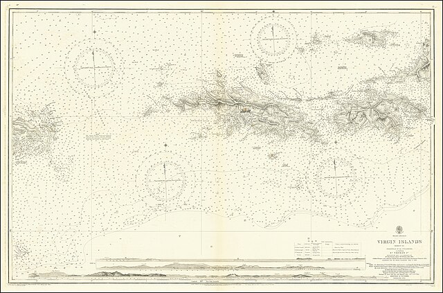
English: Virgin Islands Sheet III Tortoal Ed. To Culebra including St. Thomas Surveyed by Liuet. G.B. Lawrance R.N. Mr. Johjn Parson, Master, Mr. Jas. Tuson Mate, 1852. Culebra, Vieques and adjacent isalands from the United States Government Charts to 1914. Amendments from the Danish Government Chart of 1914. |
||||||||||
| Date | |||||||||||
| Source | https://www.raremaps.com/gallery/detail/67696/virgin-islands-sheet-iii-tortoal-ed-to-culebra-including-st-british-admiralty | ||||||||||
| Author |
|
||||||||||
| Object location | | View this and other nearby images on: OpenStreetMap |
|---|
Licensing
edit
This work created by the United Kingdom Government is in the public domain.
This is because it is one of the following:
HMSO has declared that the expiry of Crown Copyrights applies worldwide (ref: HMSO Email Reply)
|
 |
File history
Click on a date/time to view the file as it appeared at that time.
| Date/Time | Thumbnail | Dimensions | User | Comment | |
|---|---|---|---|---|---|
| current | 16:50, 11 July 2020 | | 23,952 × 15,829 (49.58 MB) | Balkanique (talk | contribs) | Uploaded a work by British Admiralty from https://www.raremaps.com/gallery/detail/67696/virgin-islands-sheet-iii-tortoal-ed-to-culebra-including-st-british-admiralty with UploadWizard |
You cannot overwrite this file.
File usage on Commons
The following page uses this file:
- File:Virgin Islands Sheet III.jpg (file redirect)