File:Aerial Crater Lake (cropped).jpg

Size of this preview: 800 × 533 pixels. Other resolutions: 320 × 213 pixels | 640 × 427 pixels | 1,024 × 683 pixels | 1,280 × 853 pixels | 2,400 × 1,600 pixels.
Original file (2,400 × 1,600 pixels, file size: 1.98 MB, MIME type: image/jpeg)
Captions
Captions
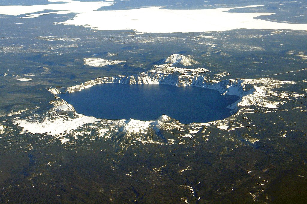
Crater Lake, Wizard Island, and Mount Scott from the air
Summary edit
.jpg&action=edit§ion=1)
| Description | |
| Date | |
| Source |
This file was derived from: Aerial Crater Lake.jpg: |
| Author |
Mike Doukas, USGS
|
Licensing edit
.jpg&action=edit§ion=2)
This image is in the public domain in the United States because it only contains materials that originally came from the United States Geological Survey, an agency of the United States Department of the Interior. For more information, see the official USGS copyright policy.
|
| Annotations | This image is annotated: View the annotations at Commons |
.jpg)
File history
Click on a date/time to view the file as it appeared at that time.
| Date/Time | Thumbnail | Dimensions | User | Comment | |
|---|---|---|---|---|---|
| current | 09:00, 17 November 2018 | | 2,400 × 1,600 (1.98 MB) | Maps and stuff (talk | contribs) | User created page with UploadWizard |
You cannot overwrite this file.
File usage on Commons
The following 2 pages use this file:
File usage on other wikis
The following other wikis use this file:
- Usage on en.wikipedia.org
- Usage on es.wikipedia.org
- Usage on fr.wikipedia.org
- Usage on it.wikipedia.org
- Usage on pt.wikipedia.org
- Usage on uk.wikipedia.org
.jpg&oldid=782591691)