File:Aerial View of North Hatley.png

Size of this preview: 800 × 350 pixels. Other resolutions: 320 × 140 pixels | 640 × 280 pixels | 1,024 × 448 pixels | 1,823 × 798 pixels.
Original file (1,823 × 798 pixels, file size: 1.45 MB, MIME type: image/png)
Captions
Captions
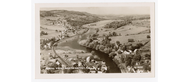
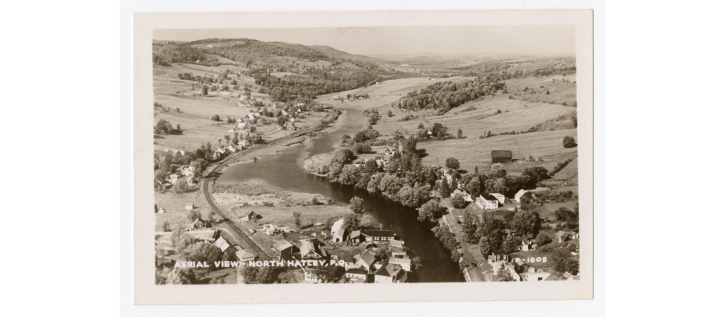
An aerial view of the village of North Hatley, Quebec, dated to somewhere between 1930 and 1950.
Summary
edit
| Description |
English: An aerial view of the Quebecois village of North Hatley, dated to somewhere between 1930 and 1950. The road on the left heads to Sherbrooke, while the Massawippi river flows in the center. |
| Date | |
| Source | https://numerique.banq.qc.ca/patrimoine/details/52327/2723231?docsearchtext=North%20Hatley |
| Author | Montreal :Associated Screen News Limited |
Licensing
edit
 |
The author of this work is anonymous and this work was made available to the public more than 50 years ago. According to the Berne convention Art. 7, and the laws of many countries, this work is in the public domain.
Note: This template does not apply to works from countries that extended the Berne Convention or that did not sign it. In particular, this includes the European Union, the United States, India, and Russia. Please use {{PD-anon-70-EU}}, {{PD-US}}, {{PD-India}}, {{PD-Russia-1996}}, etc. in such cases and check Commons:Anonymous works every time, carefully! |
File history
Click on a date/time to view the file as it appeared at that time.
| Date/Time | Thumbnail | Dimensions | User | Comment | |
|---|---|---|---|---|---|
| current | 17:41, 10 April 2024 | | 1,823 × 798 (1.45 MB) | Funrastic (talk | contribs) | Uploaded a work by Montreal :Associated Screen News Limited from https://numerique.banq.qc.ca/patrimoine/details/52327/2723231?docsearchtext=North%20Hatley with UploadWizard |
You cannot overwrite this file.
File usage on Commons
There are no pages that use this file.