File:Aerial View of Prajuab.jpg

Size of this preview: 800 × 598 pixels. Other resolutions: 320 × 239 pixels | 640 × 478 pixels | 1,024 × 765 pixels | 1,280 × 956 pixels | 2,592 × 1,936 pixels.
Original file (2,592 × 1,936 pixels, file size: 1.5 MB, MIME type: image/jpeg)
Captions
Captions
Add a one-line explanation of what this file represents
Summary
edit
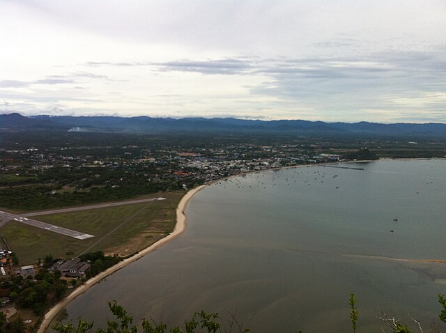
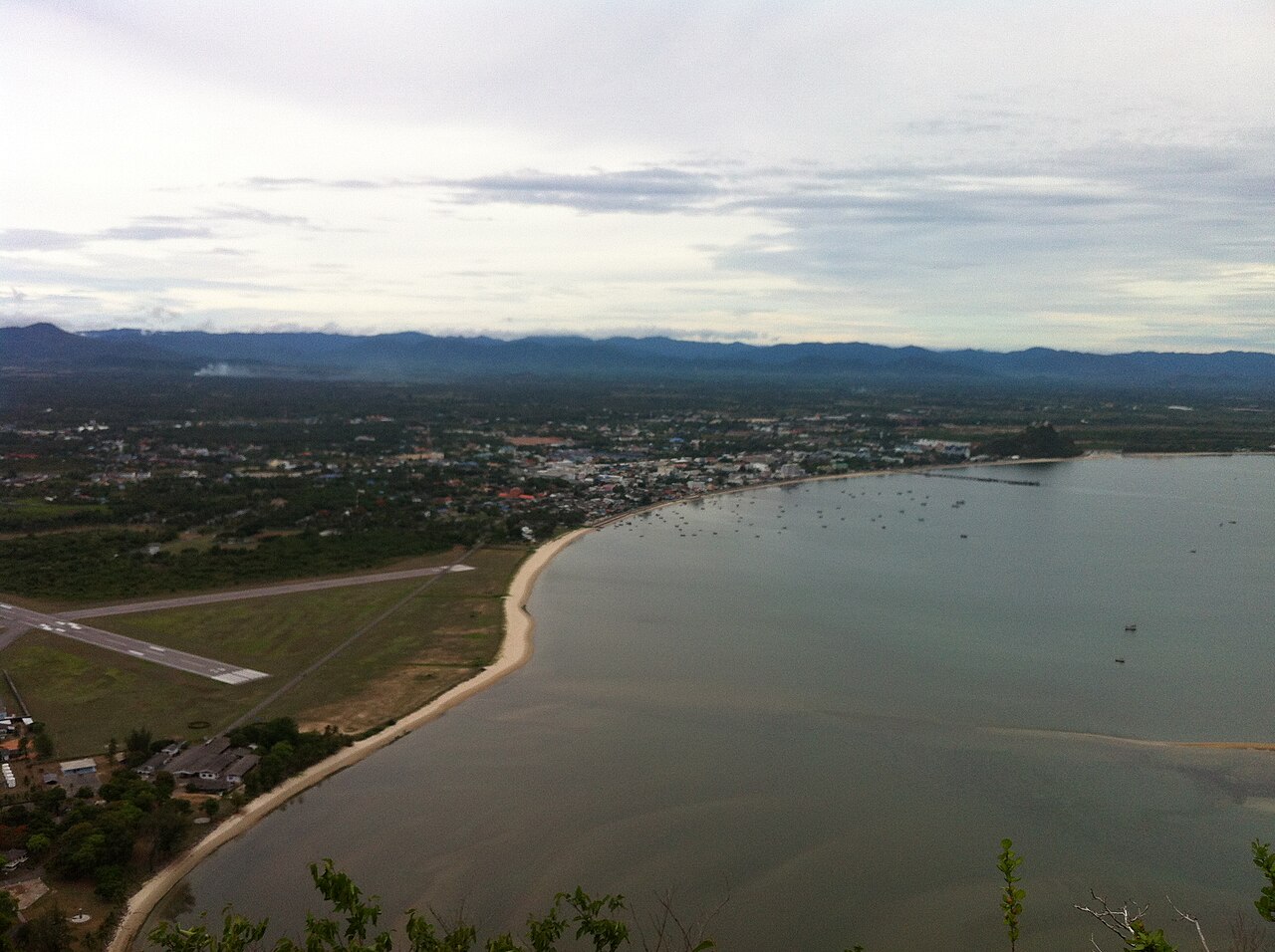
| Description | Aerial View of Prajuab township (Amphur muang) in Prajuab Khiri Khan province, Thailand. Photographed looking north, taken from the peak of Khao Lom Muak hill inside Wing 5 Air Force base |
| Date | 4 June 2014 (according to Exif data) |
| Source | Own work |
| Author | dahlfred |
| Camera location | | View this and other nearby images on: OpenStreetMap |
|---|
Licensing
edit
I, the copyright holder of this work, hereby publish it under the following license:
This file is licensed under the Creative Commons Attribution-Share Alike 3.0 Unported license.
- You are free:
- to share – to copy, distribute and transmit the work
- to remix – to adapt the work
- Under the following conditions:
- attribution – You must give appropriate credit, provide a link to the license, and indicate if changes were made. You may do so in any reasonable manner, but not in any way that suggests the licensor endorses you or your use.
- share alike – If you remix, transform, or build upon the material, you must distribute your contributions under the same or compatible license as the original.
| This file was uploaded via Mobile iOS 1.0.10. |
File history
Click on a date/time to view the file as it appeared at that time.
| Date/Time | Thumbnail | Dimensions | User | Comment | |
|---|---|---|---|---|---|
| current | 12:54, 4 June 2014 | | 2,592 × 1,936 (1.5 MB) | Dahlfred (talk | contribs) | Uploaded with Commons for iOS |
You cannot overwrite this file.
File usage on Commons
The following 3 pages use this file:
File usage on other wikis
The following other wikis use this file:
- Usage on fr.wikipedia.org
- Usage on it.wikipedia.org
- Usage on pt.wikipedia.org
- Usage on th.wikipedia.org