File:Africa Climate Today.png

Size of this preview: 600 × 600 pixels. Other resolutions: 240 × 240 pixels | 480 × 480 pixels | 768 × 768 pixels | 1,024 × 1,024 pixels | 1,320 × 1,320 pixels.
Original file (1,320 × 1,320 pixels, file size: 131 KB, MIME type: image/png)
Captions
Captions
Add a one-line explanation of what this file represents
Summary edit
| Description |
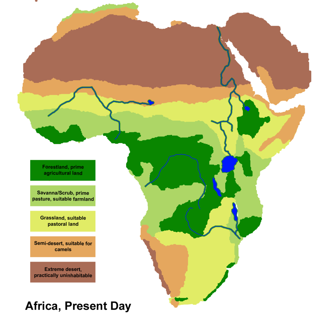
English: Climate areas based on data and maps from the Oak Ridge National Laboratory Paleovegitation project http://www.esd.ornl.gov/projects/qen/
This map is for optimum current conditions based on the world's climate today. |
| Date | |
| Source | Own work |
| Author | Ingoman |
Licensing edit
| I, the copyright holder of this work, release this work into the public domain. This applies worldwide. In some countries this may not be legally possible; if so: I grant anyone the right to use this work for any purpose, without any conditions, unless such conditions are required by law. |

|
This meteorology image could be re-created using vector graphics as an SVG file. This has several advantages; see Commons:Media for cleanup for more information. If an SVG form of this image is available, please upload it and afterwards replace this template with
{{vector version available|new image name}}.
It is recommended to name the SVG file “Africa Climate Today.svg”—then the template Vector version available (or Vva) does not need the new image name parameter. |
File history
Click on a date/time to view the file as it appeared at that time.
| Date/Time | Thumbnail | Dimensions | User | Comment | |
|---|---|---|---|---|---|
| current | 04:05, 21 December 2010 | | 1,320 × 1,320 (131 KB) | Ingoman (talk | contribs) | {{Information |Description={{en|1=Climate areas based on data and maps from the Oak Ridge National Laboratory Paleovegitation project http://www.esd.ornl.gov/projects/qen/ This map is for optimum current conditions based on the world's climate today.}} |S |
You cannot overwrite this file.
File usage on Commons
There are no pages that use this file.
File usage on other wikis
The following other wikis use this file:
- Usage on uk.wikipedia.org