File:African grey woodpecker distribution map.svg

Size of this PNG preview of this SVG file: 730 × 600 pixels. Other resolutions: 292 × 240 pixels | 584 × 480 pixels | 935 × 768 pixels | 1,247 × 1,024 pixels | 2,493 × 2,048 pixels | 1,289 × 1,059 pixels.
Original file (SVG file, nominally 1,289 × 1,059 pixels, file size: 302 KB)
Captions
Captions
Add a one-line explanation of what this file represents
Summary
edit
| Description |
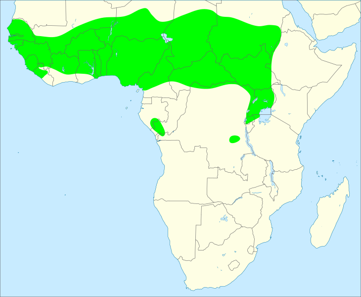
English: Geographic distribution of the African grey woodpecker (Dendropicos goertae)
Note that the map assumes that the Eastern grey woodpecker (Picidae spodocephalus) is split from the African grey woodpecker. The distribution is based on:
|
| Date | |
| Source | Own work |
| Author | Aa77zz |
Licensing
edit
I, the copyright holder of this work, hereby publish it under the following license:
| This file is made available under the Creative Commons CC0 1.0 Universal Public Domain Dedication. | |
| The person who associated a work with this deed has dedicated the work to the public domain by waiving all of their rights to the work worldwide under copyright law, including all related and neighboring rights, to the extent allowed by law. You can copy, modify, distribute and perform the work, even for commercial purposes, all without asking permission.
|
File history
Click on a date/time to view the file as it appeared at that time.
| Date/Time | Thumbnail | Dimensions | User | Comment | |
|---|---|---|---|---|---|
| current | 17:13, 23 May 2020 | | 1,289 × 1,059 (302 KB) | Aa77zz (talk | contribs) | {{Information |description={{en|1=Geographic distribution of the African grey woodpecker (''Dendropicos goertae'') Note that the map assumes that the Eastern grey woodpecker (''Picidae spodocephalus'') is split from the African grey woodpecker. The distribution is based on: *Fuchs, J.; Pons, J.-M.; Bowie, R.C.K. (2017). "Biogeography and diversification dynamics of the African woodpeckers". ''Molecular Phylogenetics and Evolution''. '''108''': 88–100. doi:10... |
You cannot overwrite this file.
File usage on Commons
There are no pages that use this file.
File usage on other wikis
The following other wikis use this file:
- Usage on ceb.wikipedia.org
- Usage on de.wikipedia.org
- Usage on en.wikipedia.org
- Usage on nl.wikipedia.org
- Usage on pt.wikipedia.org
- Usage on uk.wikipedia.org