File:Aftakkingskanaal naar Hasselt - Vandermaelen.png

Size of this preview: 424 × 600 pixels. Other resolutions: 170 × 240 pixels | 339 × 480 pixels | 543 × 768 pixels | 724 × 1,024 pixels | 1,448 × 2,048 pixels | 7,015 × 9,921 pixels.
Original file (7,015 × 9,921 pixels, file size: 127.46 MB, MIME type: image/png)
Captions
Captions
Add a one-line explanation of what this file represents
Summary
edit
| Description |
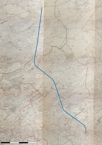
Nederlands: Een weergave van "Cartes topographiques de la Belgique, 1846 - 1854" met daarop het Aftakkingskanaal naar Hasselt aangeduid |
| Date | |
| Source | http://www.geopunt.be/catalogus/datasetfolder/93795cd6-66d3-4310-83b2-5443adfee403 |
| Author | AGIV and KBR |
| Camera location | | View this and other nearby images on: OpenStreetMap |
|---|
Licensing
edit
|
This work is in the public domain in its country of origin and other countries and areas where the copyright term is the author's life plus 70 years or fewer. This work is in the public domain in the United States because it was published (or registered with the U.S. Copyright Office) before January 1, 1929. | |
| This file has been identified as being free of known restrictions under copyright law, including all related and neighboring rights. | |
File history
Click on a date/time to view the file as it appeared at that time.
| Date/Time | Thumbnail | Dimensions | User | Comment | |
|---|---|---|---|---|---|
| current | 13:27, 26 May 2021 | | 7,015 × 9,921 (127.46 MB) | Lowie2028 (talk | contribs) | Uploaded a work by AGIV and KBR from http://www.geopunt.be/catalogus/datasetfolder/93795cd6-66d3-4310-83b2-5443adfee403 with UploadWizard |
You cannot overwrite this file.
File usage on Commons
The following page uses this file:
File usage on other wikis
The following other wikis use this file:
- Usage on nl.wikipedia.org