File:Agni-V during its first test flight.jpg

Size of this preview: 599 × 600 pixels. Other resolutions: 240 × 240 pixels | 479 × 480 pixels | 767 × 768 pixels | 1,022 × 1,024 pixels | 1,887 × 1,890 pixels.
Original file (1,887 × 1,890 pixels, file size: 908 KB, MIME type: image/jpeg)
Captions
Captions
Add a one-line explanation of what this file represents
Summary edit
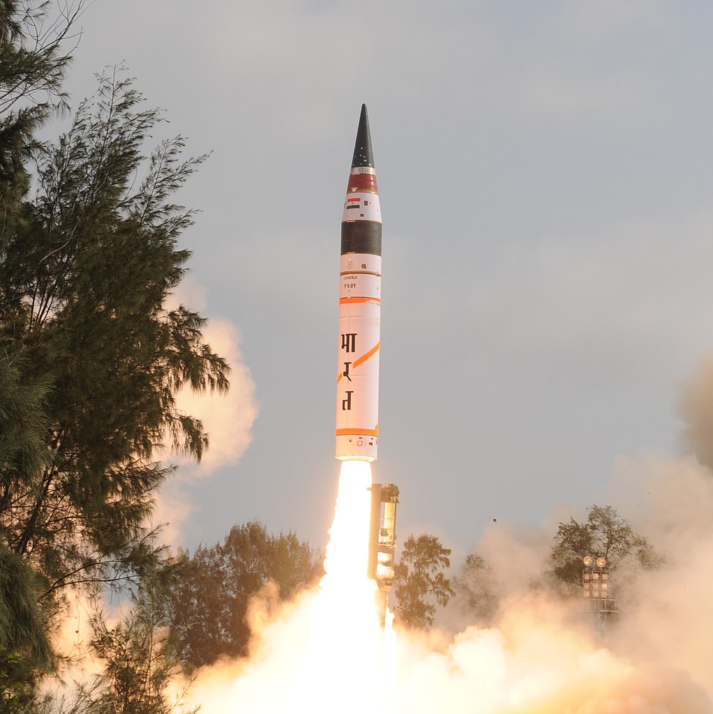
| Description |
English: First test flight of Agni-V on 19 April 2012 from Integrated Test Range, Wheeler Island, Orissa. |
| Date | |
| Source | https://www.drdo.gov.in/drdo/English/index.jsp?pg=agni_5.jsp |
| Author | DRDO / Ministry of Defence, Government of India |
| Other versions |
.jpg)
| Camera location | | View this and other nearby images on: OpenStreetMap |
|---|
Licensing edit

|
This file is a copyrighted work of the Government of India, licensed under the Government Open Data License - India (GODL).
Information on Related Items:
|
 |
|
|
This image, which was originally posted in the source indicated above, was reviewed on 2018-06-20 by the administrator or reviewer Jkadavoor, who confirmed that it was available on that source on that date.
|
File history
Click on a date/time to view the file as it appeared at that time.
| Date/Time | Thumbnail | Dimensions | User | Comment | |
|---|---|---|---|---|---|
| current | 01:54, 14 August 2018 | | 1,887 × 1,890 (908 KB) | Gazoth (talk | contribs) | Tighter crop - File:First test flight of Agni-V (4).jpg cropped 34 % horizontally, 56 % vertically using CropTool with lossless mode. |
| 01:50, 14 August 2018 |  | 2,278 × 2,277 (1.27 MB) | Gazoth (talk | contribs) | File:First test flight of Agni-V (4).jpg cropped 20 % horizontally, 47 % vertically using CropTool with precise mode. |
You cannot overwrite this file.
File usage on Commons
The following 3 pages use this file:
File usage on other wikis
The following other wikis use this file:
- Usage on bn.wikipedia.org
- Usage on en.wikipedia.org
- Usage on eo.wikiquote.org
- Usage on es.wikipedia.org
- Usage on fi.wikipedia.org
- Usage on fr.wikipedia.org
- Usage on he.wikipedia.org
- Usage on ja.wikipedia.org
- Usage on no.wikipedia.org
- Usage on pl.wikipedia.org
- Usage on sr.wikipedia.org
- Usage on www.wikidata.org