File:Airolo - connecting corridor numbered.svg

Size of this PNG preview of this SVG file: 512 × 199 pixels. Other resolutions: 320 × 124 pixels | 640 × 249 pixels | 1,024 × 398 pixels | 1,280 × 498 pixels | 2,560 × 995 pixels.
Original file (SVG file, nominally 512 × 199 pixels, file size: 10 KB)
Captions
Captions
Add a one-line explanation of what this file represents
Summary edit
| Object location | | View this and other nearby images on: OpenStreetMap |
|---|
| Description |
[] English: Note: See the version numbered to create or enhance one translation.
|
|||||||||
| Date | ||||||||||
| Source | Airolo - Couloir de liaison.gif | |||||||||
| Author |
|
|||||||||
| Other versions |
[]
|
|||||||||
| SVG development | This map was created with Adobe Illustrator. |
|||||||||
| Assessments |
|


Translations edit
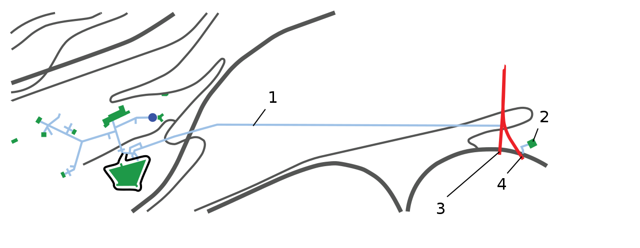
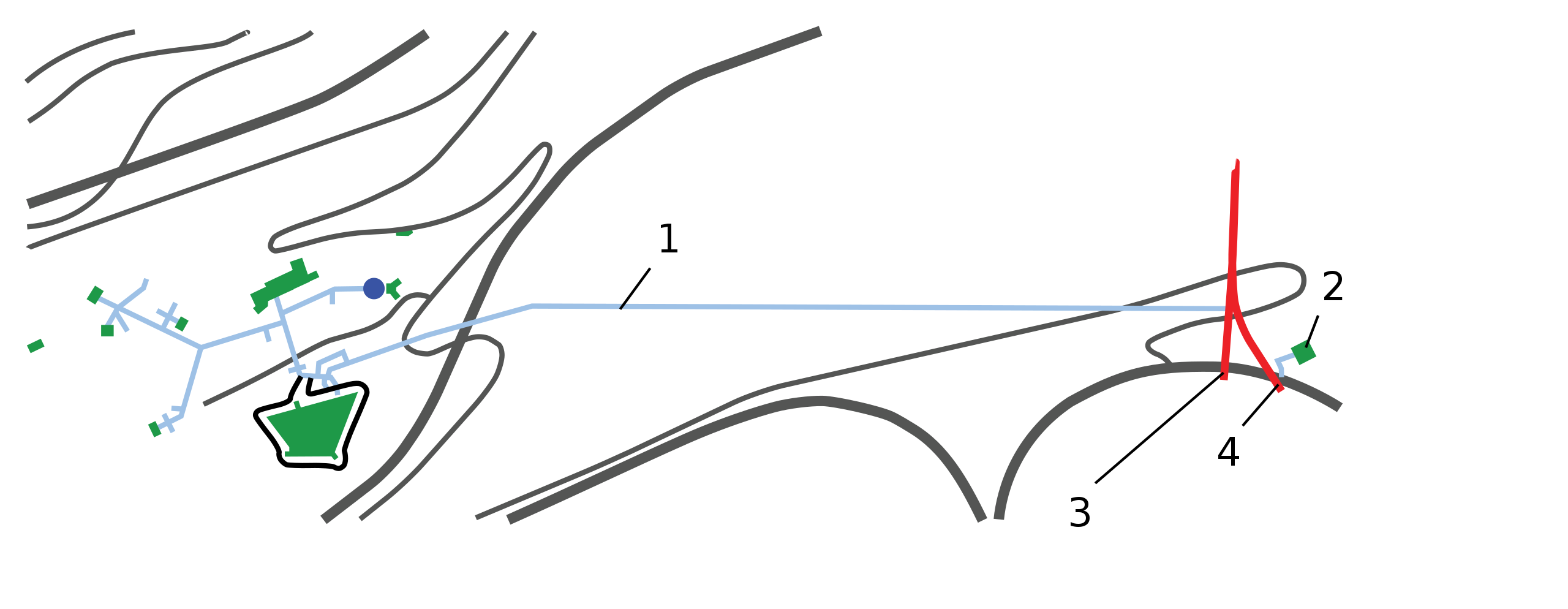
| Language | 1 | 2 | 3 | 4 | |
|---|---|---|---|---|---|
| en | English | Connection tunnel | Bunker | Tunnel for the construction | Railway tunnel |
| fr | French | Tunnel de liaison | Blockhaus | Tunnel servant à la construction | Tunnel ferroviaire |
| de | German | Verbindungstunnel zum Südportal | Blockhaus | Hilfstunnel für den Bau | Bahntunnel |
Licensing edit
I, the copyright holder of this work, hereby publish it under the following license:
This file is licensed under the Creative Commons Attribution-Share Alike 4.0 International license.
- You are free:
- to share – to copy, distribute and transmit the work
- to remix – to adapt the work
- Under the following conditions:
- attribution – You must give appropriate credit, provide a link to the license, and indicate if changes were made. You may do so in any reasonable manner, but not in any way that suggests the licensor endorses you or your use.
- share alike – If you remix, transform, or build upon the material, you must distribute your contributions under the same or compatible license as the original.
File history
Click on a date/time to view the file as it appeared at that time.
| Date/Time | Thumbnail | Dimensions | User | Comment | |
|---|---|---|---|---|---|
| current | 13:47, 13 January 2015 | 512 × 199 (10 KB) | Medium69 (talk | contribs) | Ajustement | |
| 13:29, 12 January 2015 | 512 × 184 (9 KB) | Medium69 (talk | contribs) | Changement de police de caractères | ||
| 12:27, 20 December 2014 | 512 × 184 (9 KB) | Medium69 (talk | contribs) | Légères corrections | ||
| 22:09, 15 December 2014 | 512 × 184 (9 KB) | Medium69 (talk | contribs) | Valid SVG | ||
| 22:24, 8 December 2014 | 512 × 184 (10 KB) | Medium69 (talk | contribs) | User created page with UploadWizard |
You cannot overwrite this file.
File usage on Commons
The following 11 pages use this file:
- User:Liesel/Rail transport/2014 December 1-10
- User talk:Medium69/archives/2014/12
- Commons:Quality images/Subject/Non photographic media
- Commons:Quality images candidates/Archives December 24 2014
- Commons:Valued image candidates/Airolo - connecting corridor numbered.svg
- File:Airolo - connecting corridor-en.svg
- File:Airolo - connecting corridor-fr.svg
- File:Airolo - connecting corridor arrows.svg
- File:Airolo - connecting corridor numbered.svg
- File:Airolo - connecting corridor unlabeled.svg
- Template:Other versions/Airolo - connecting corridor
File usage on other wikis
The following other wikis use this file:
- Usage on de.wikipedia.org