File:Airport Surveillance Radar.jpg
Size of this preview: 800 × 600 pixels. Other resolutions: 320 × 240 pixels | 640 × 480 pixels | 1,024 × 768 pixels | 1,200 × 900 pixels.
Original file (1,200 × 900 pixels, file size: 808 KB, MIME type: image/jpeg)
Captions
Captions
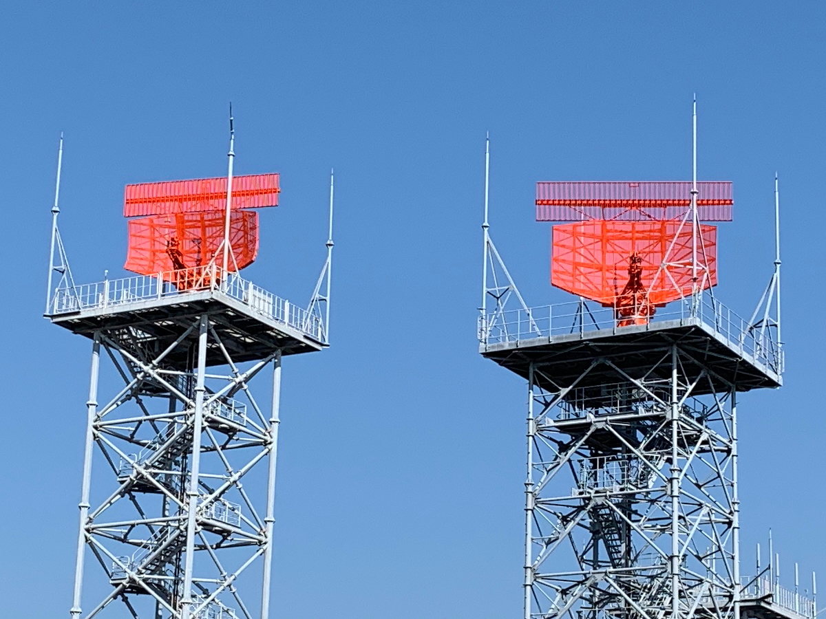
Airport Surveillance Radar Tower Secondary Surveillance Radar (top) and Primary Surveillance Radar (bottom)
Summary edit
| Description |
日本語: 空港監視レーダー塔の二次監視レーダー(上)と一次監視レーダー(下)
English: Airport Surveillance Radar Tower Secondary Surveillance Radar (top) and Primary Surveillance Radar (bottom) |
| Date | |
| Source | Own work |
| Author | Project Kei |
| Camera location | | View this and other nearby images on: OpenStreetMap |
|---|
Licensing edit
I, the copyright holder of this work, hereby publish it under the following license:
This file is licensed under the Creative Commons Attribution-Share Alike 4.0 International license.
- You are free:
- to share – to copy, distribute and transmit the work
- to remix – to adapt the work
- Under the following conditions:
- attribution – You must give appropriate credit, provide a link to the license, and indicate if changes were made. You may do so in any reasonable manner, but not in any way that suggests the licensor endorses you or your use.
- share alike – If you remix, transform, or build upon the material, you must distribute your contributions under the same or compatible license as the original.
File history
Click on a date/time to view the file as it appeared at that time.
| Date/Time | Thumbnail | Dimensions | User | Comment | |
|---|---|---|---|---|---|
| current | 01:32, 5 March 2021 | | 1,200 × 900 (808 KB) | Keita.Honda (talk | contribs) | Uploaded own work with UploadWizard |
You cannot overwrite this file.
File usage on Commons
There are no pages that use this file.
File usage on other wikis
The following other wikis use this file:
- Usage on en.wikipedia.org
- Usage on ja.wikipedia.org
- Usage on www.wikidata.org