File:Alberta's Municipal Districts.png
Size of this preview: 355 × 600 pixels. Other resolutions: 142 × 240 pixels | 284 × 480 pixels | 454 × 768 pixels | 606 × 1,024 pixels | 1,741 × 2,941 pixels.
Original file (1,741 × 2,941 pixels, file size: 307 KB, MIME type: image/png)
Captions
Captions
Add a one-line explanation of what this file represents
Summary edit
| Description |
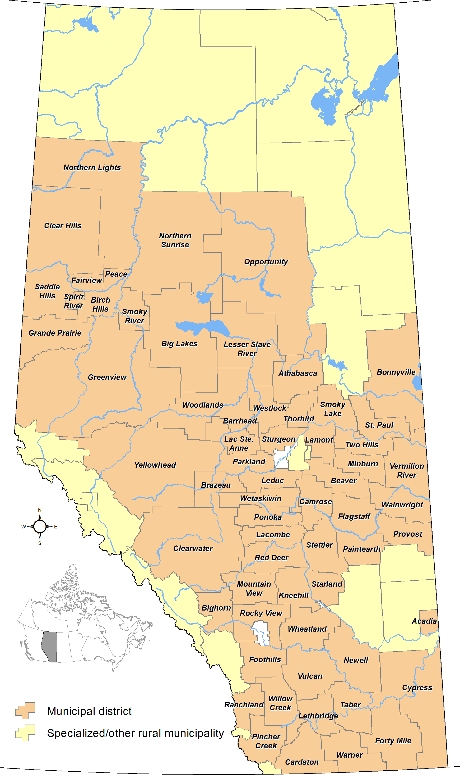
English: Map showing locations of Alberta's 63 municipal districts as of May 2020, with base reference features (major lakes and rivers). |
| Date | |
| Source | Own work |
| Author | Hwy43 |
Licensing edit
I, the copyright holder of this work, hereby publish it under the following license:
This file is licensed under the Creative Commons Attribution 3.0 Unported license.
- You are free:
- to share – to copy, distribute and transmit the work
- to remix – to adapt the work
- Under the following conditions:
- attribution – You must give appropriate credit, provide a link to the license, and indicate if changes were made. You may do so in any reasonable manner, but not in any way that suggests the licensor endorses you or your use.
File history
Click on a date/time to view the file as it appeared at that time.
| Date/Time | Thumbnail | Dimensions | User | Comment | |
|---|---|---|---|---|---|
| current | 05:46, 1 May 2021 | | 1,741 × 2,941 (307 KB) | Hwy43 (talk | contribs) | ID No. 349 dissolved on May 1, 2021 and was annexed to the MD of Bonnyville No. 87 |
| 19:13, 16 May 2020 |  | 1,741 × 2,941 (307 KB) | Hwy43 (talk | contribs) | LLBC now a SM | |
| 04:30, 29 October 2013 |  | 557 × 941 (67 KB) | Hwy43 (talk | contribs) | remove stray ID label | |
| 04:22, 29 October 2013 |  | 557 × 941 (68 KB) | Hwy43 (talk | contribs) | add labels for 64 municipal districts | |
| 03:27, 29 October 2013 |  | 557 × 941 (35 KB) | Hwy43 (talk | contribs) | User created page with UploadWizard |
You cannot overwrite this file.
File usage on Commons
The following page uses this file:
File usage on other wikis
The following other wikis use this file:
- Usage on en.wikipedia.org
- Usage on zh.wikipedia.org